Goose Island’s Development Framework
WorkUniversity of Pennsylvania · Goose Island, Chicago
Goose Island’s Development Framework
A district for digital manufacturing and design on Chicago’s Goose Island
Project snapshot
My contribution
Role
Co-designed the proposal with my studio partner, and drew all of its drawings, diagrams and renderings
Scope
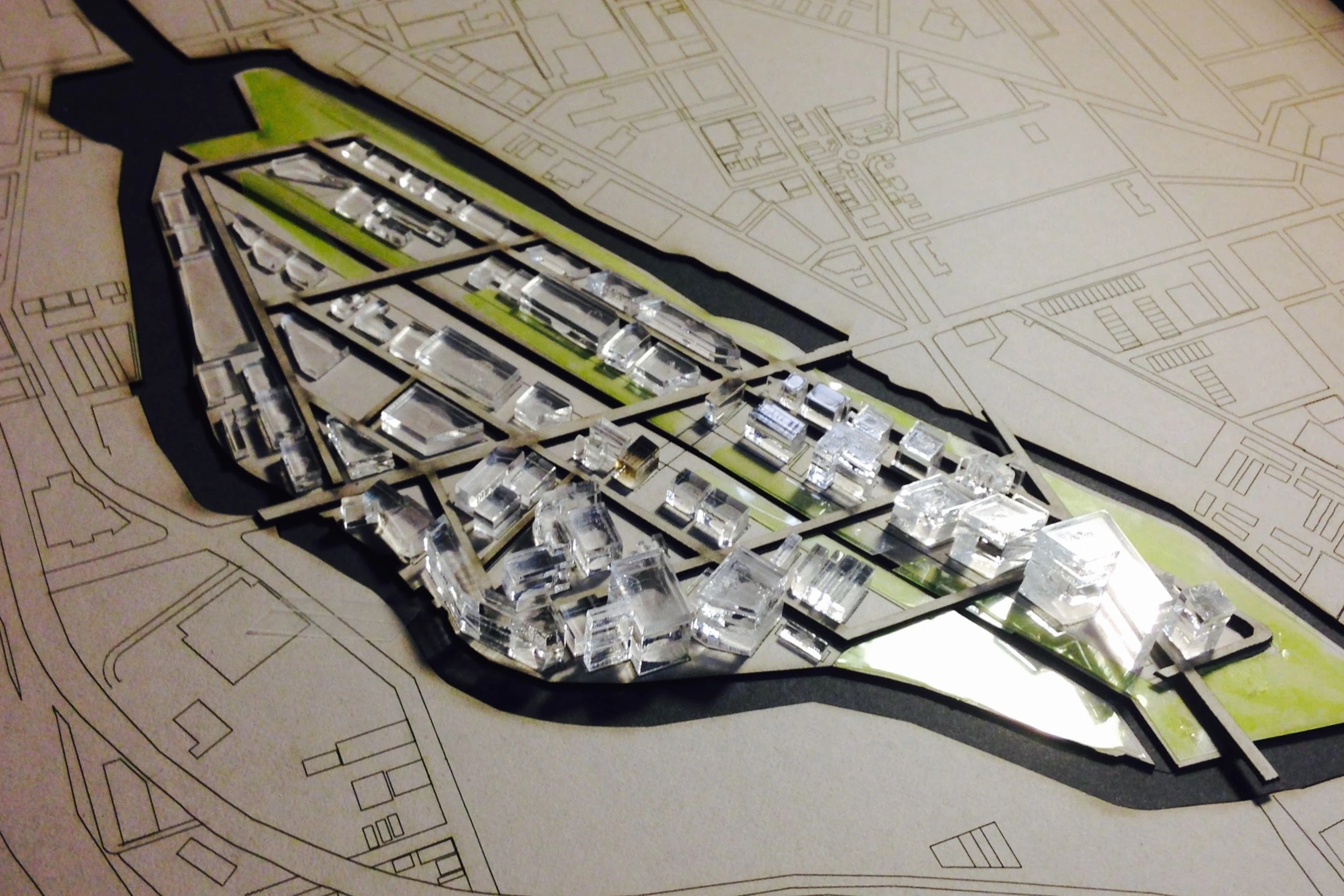
District strategy, rezoning and phasing, masterplan, axonometric and plan diagrams, perspective renderings, a study model and a project animation
With
Jungyoon Bae, studio partner • Nick Pevzner, studio critic
Project details
- Location
- Goose Island, Chicago, Illinois
- Institution
- University of Pennsylvania School of Design
- Studio
- LARP 602, Landscape Architecture & Regional Planning
- Year
- Spring 2015
- Project type
- Urban design · Strategic masterplan
- Status
- Studio proposal
00 Overview
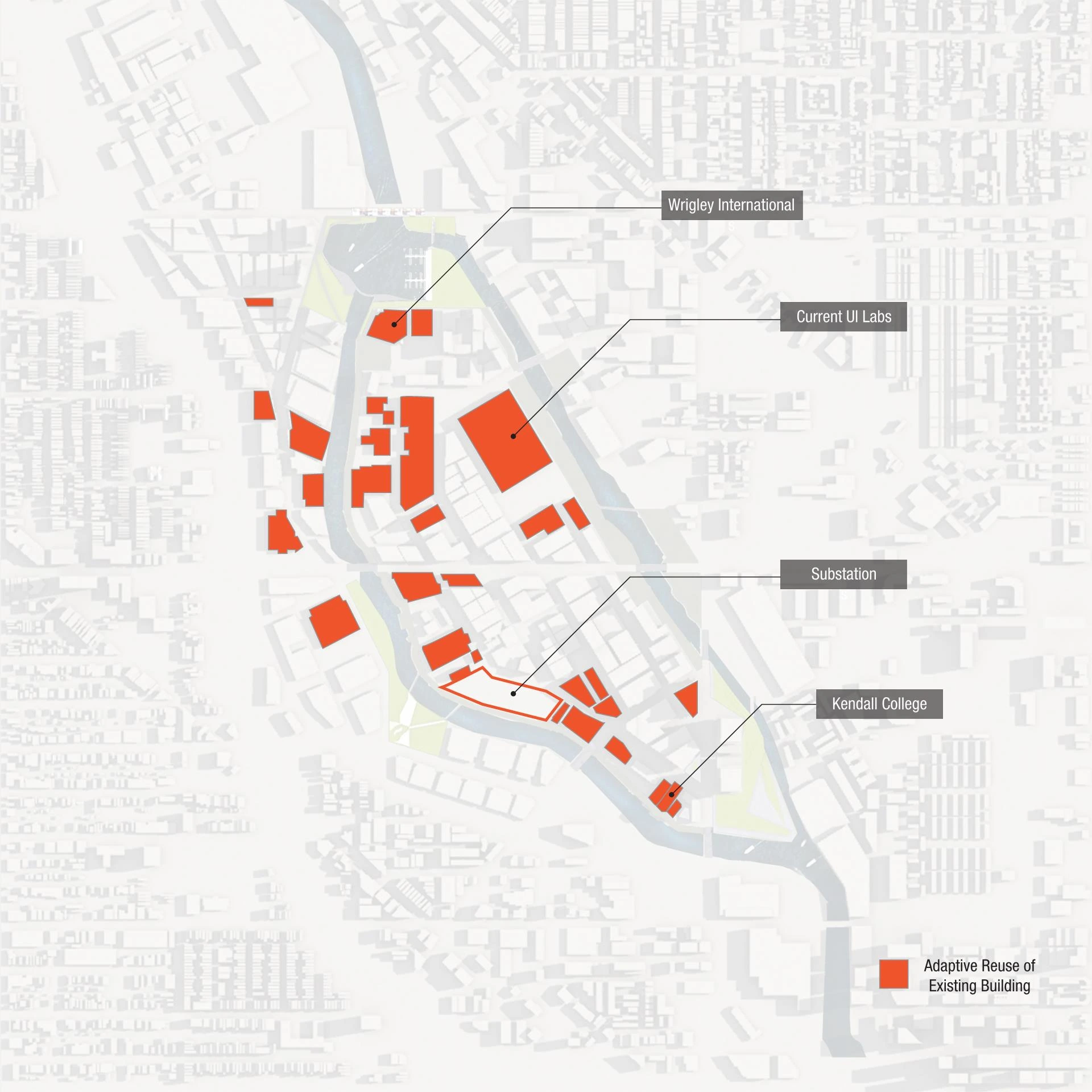
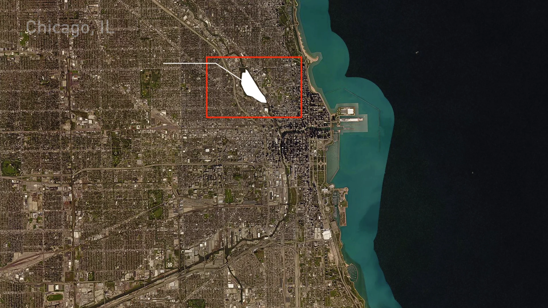
A proposal for a Digital Manufacturing & Design District on Goose Island, a long-overlooked industrial island in the Chicago River with the potential to become the Midwest’s next tech hub. The plan builds on the island’s existing infrastructure and ties it to the energy of the neighborhoods around it.
Jungyoon Bae and I developed it in a spring 2015 studio at the University of Pennsylvania. We called it Triple Hierarchy, after the three elements the strategy rests on: connectivity, open space and city blocks. Together they were meant to draw a tech workforce to live and work on the island, with quality open space and a mix of uses.
01 Five operations
Unlock the island, then build it
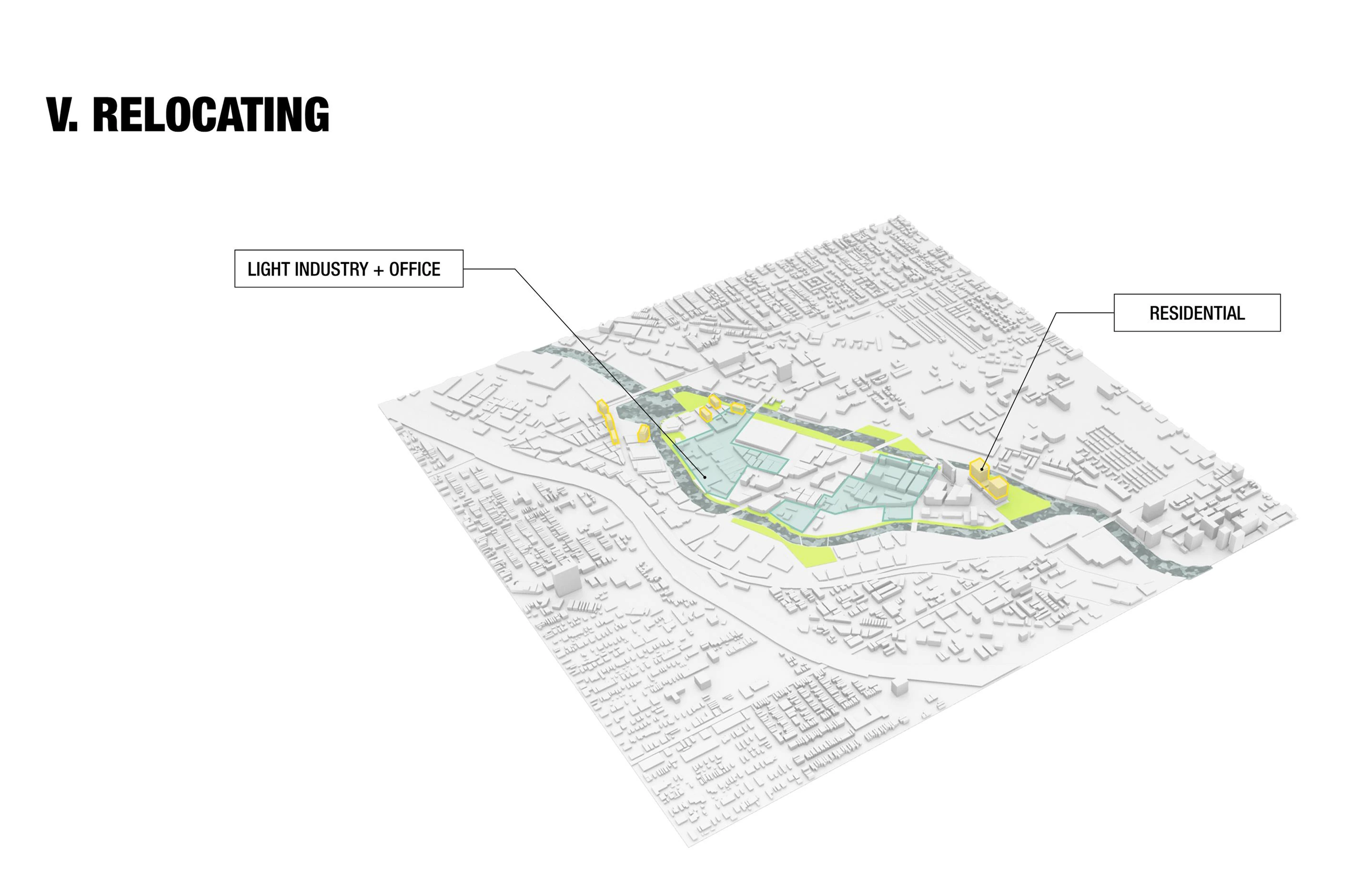
The plan is carried out in five operations, in order: move the manufacturing zoning off the island, extend the commercial streets onto it, invest in parks, connect it to its neighbors, then fill it with offices and homes.
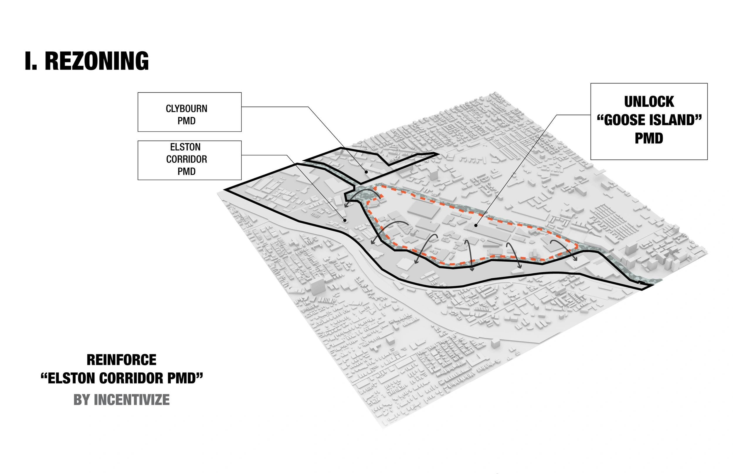
Rezoning for new development
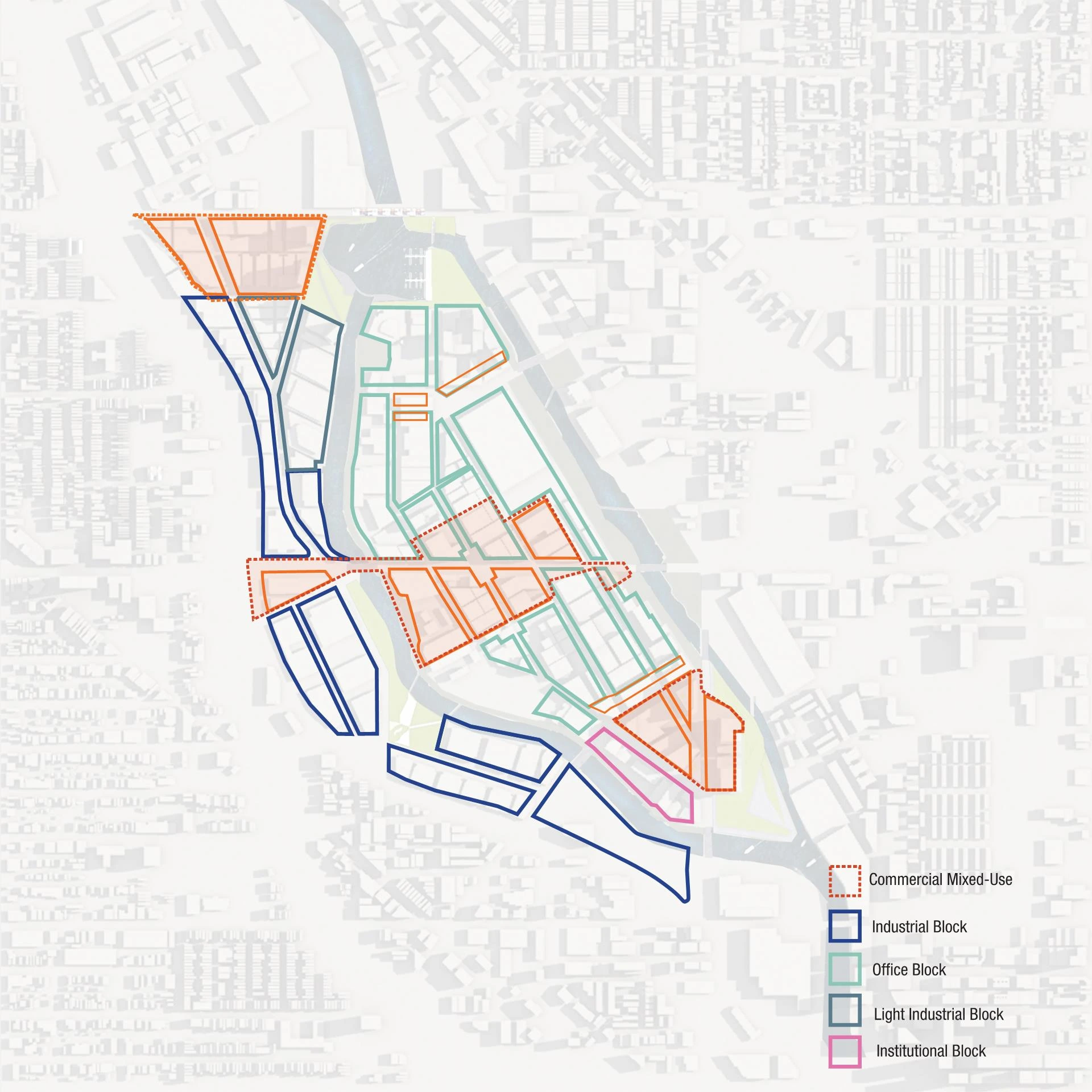
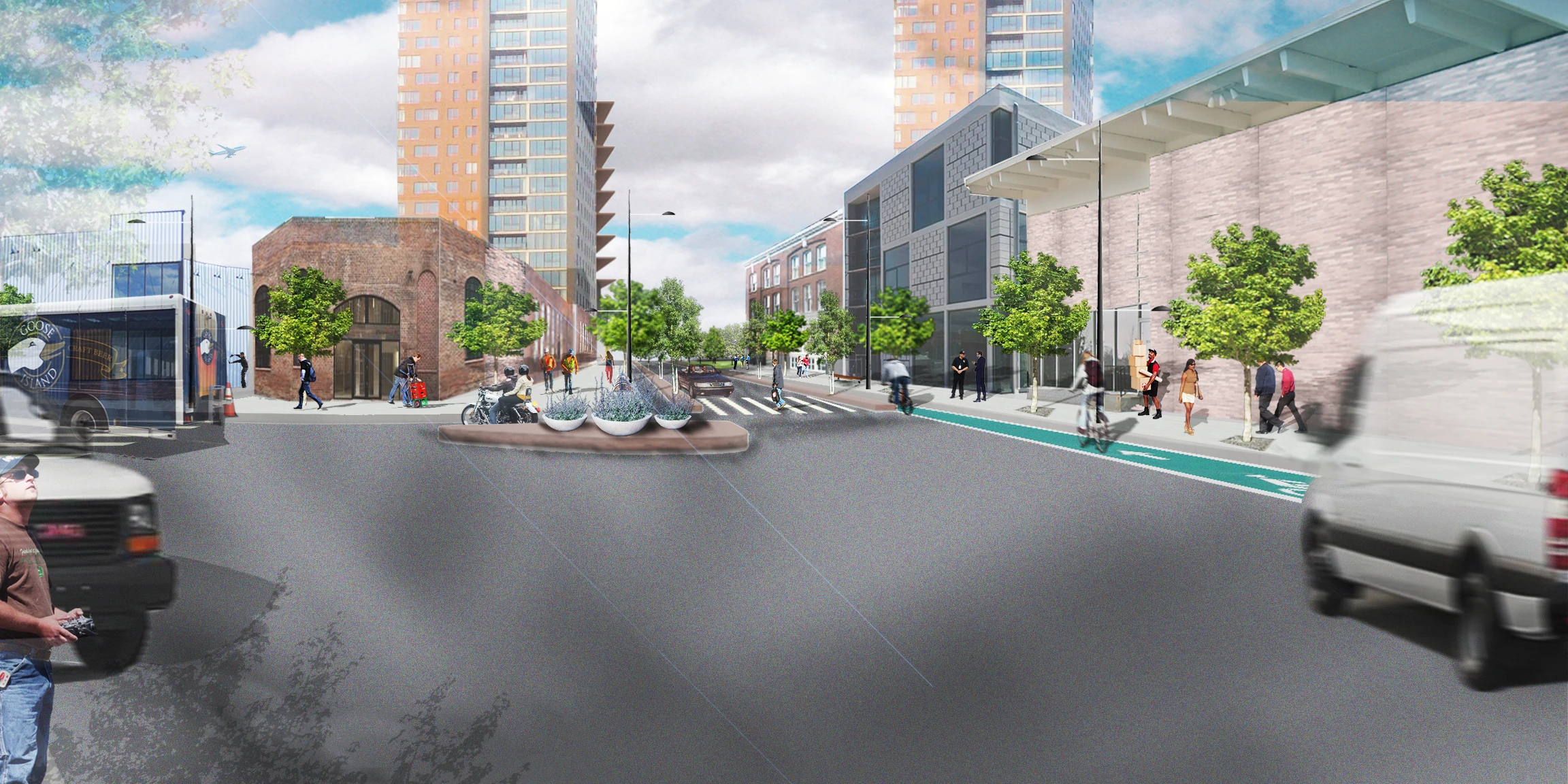
The first step moves Goose Island’s Planned Manufacturing District (PMD) to the Elston Corridor on the western edge, between the island and I-90, reinforced there with incentives. That opens the island itself to commercial and residential development.
Active mixed-use streets
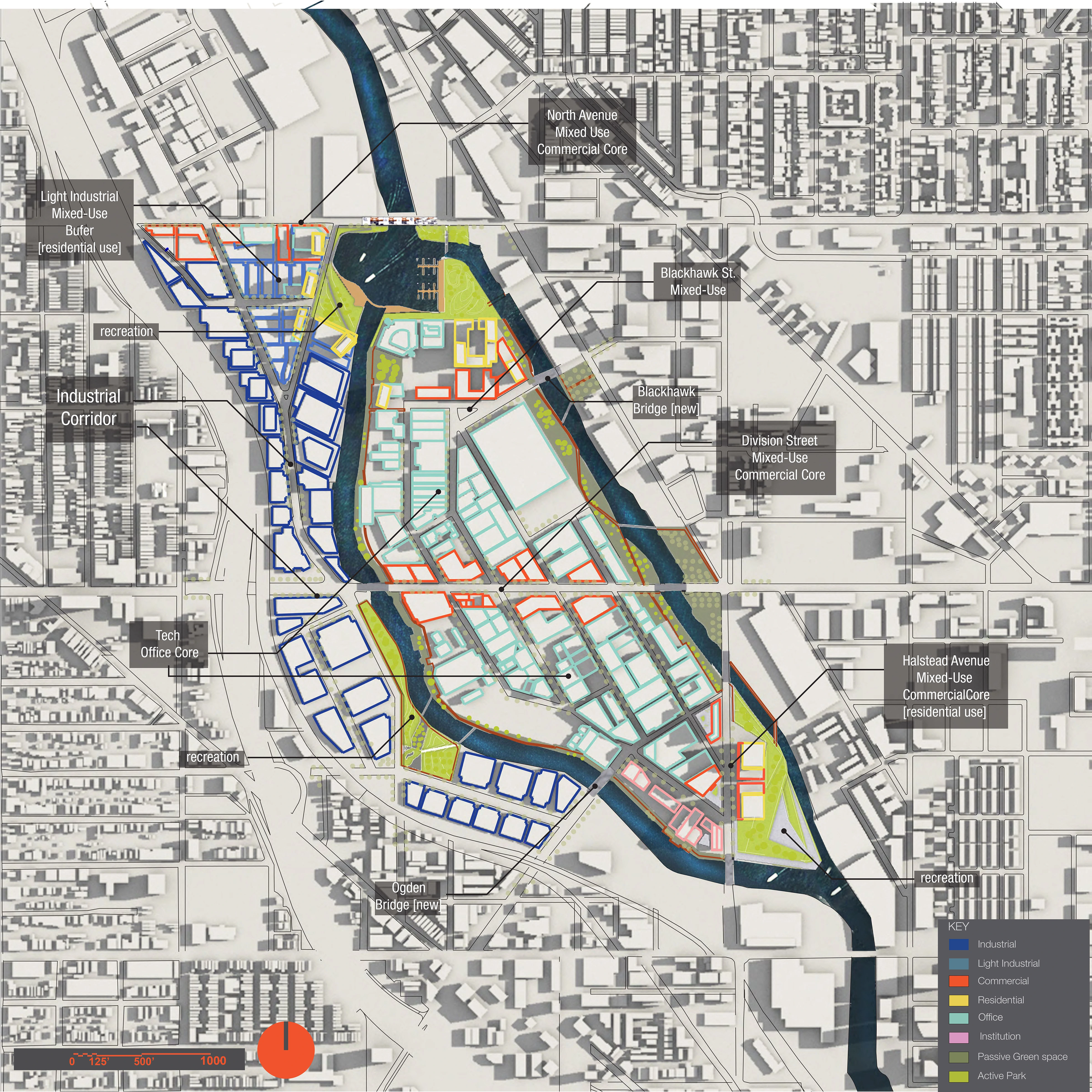
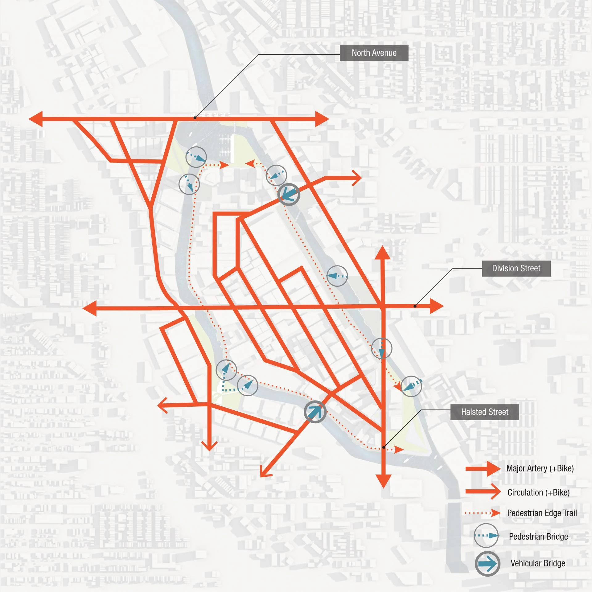
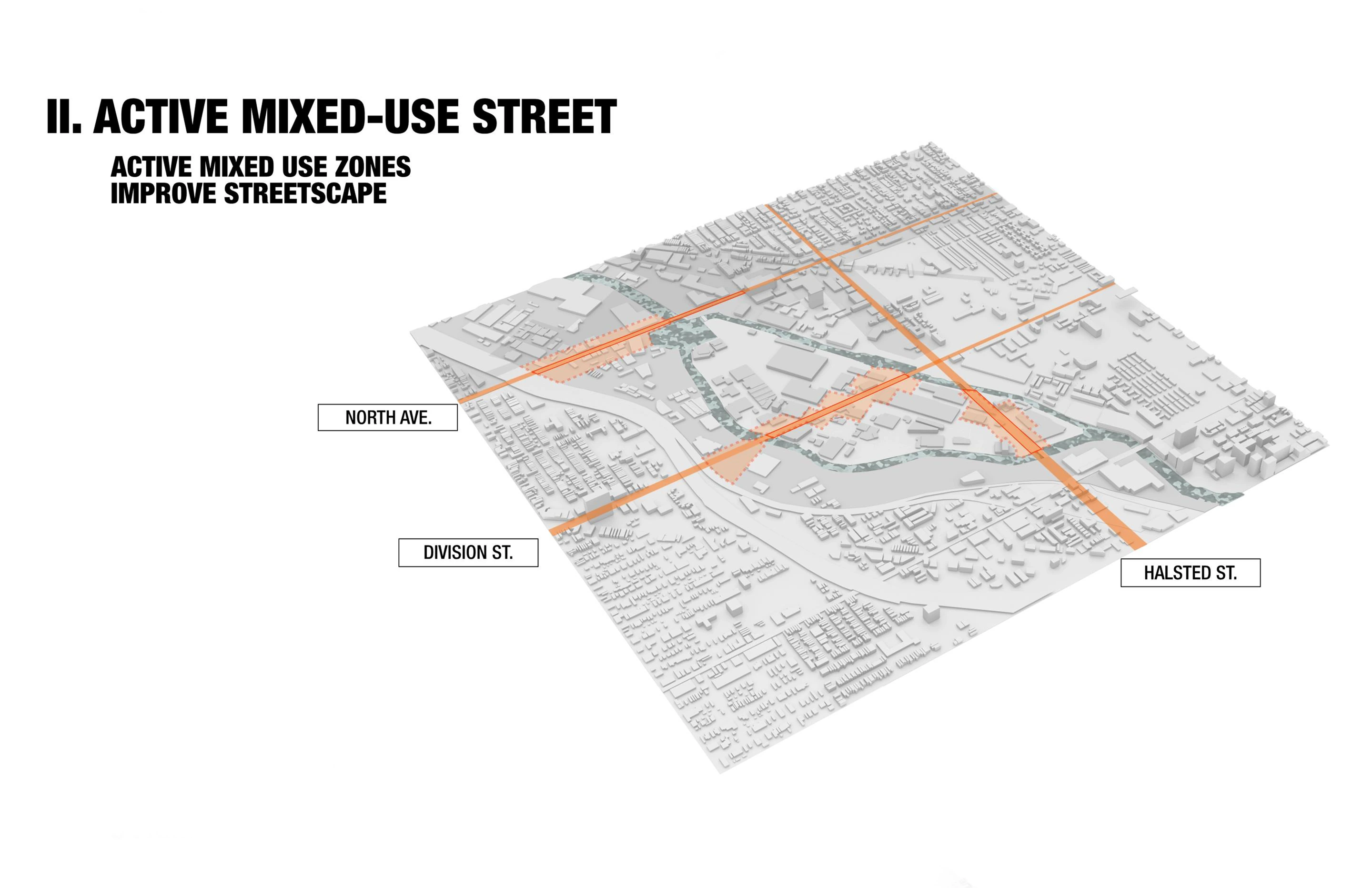
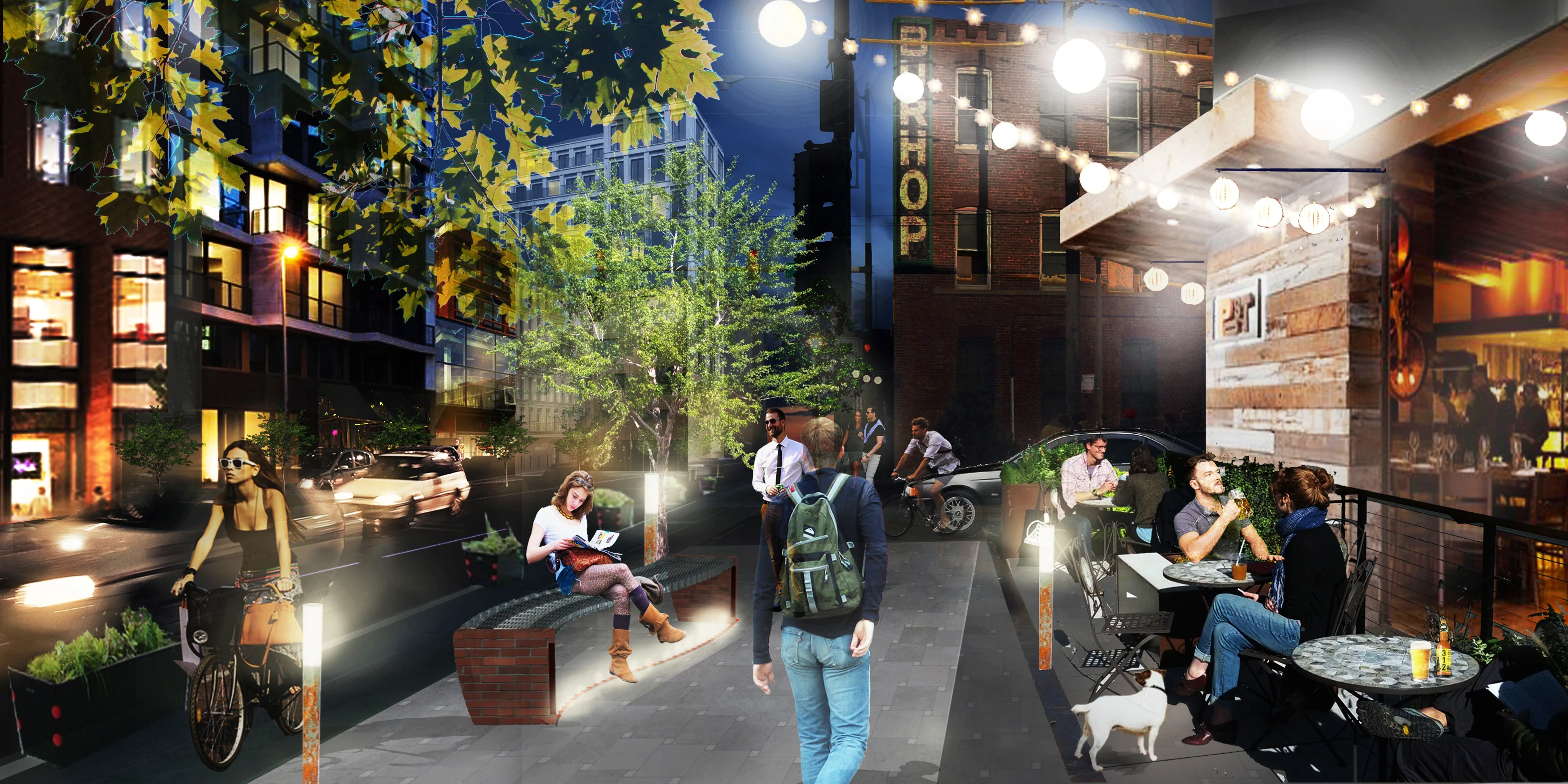
Next, three development cores on existing commercial corridors, North Avenue, Division Street and Halsted Street, extend their activity onto the island as mixed-use streets of shops, homes and offices.
Parks & open space
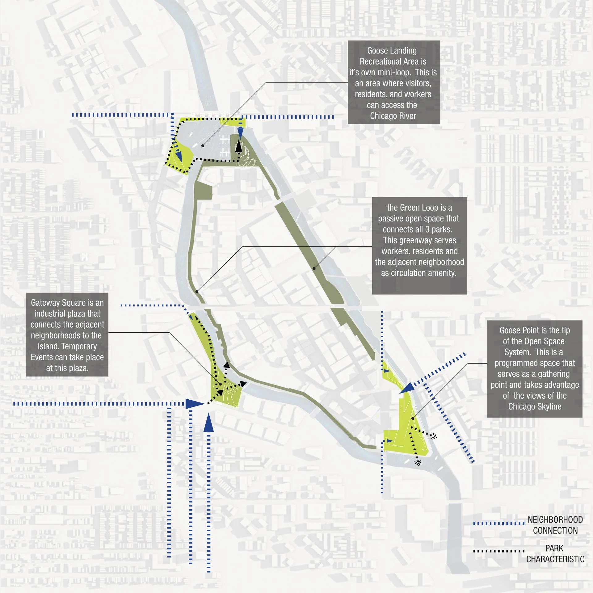
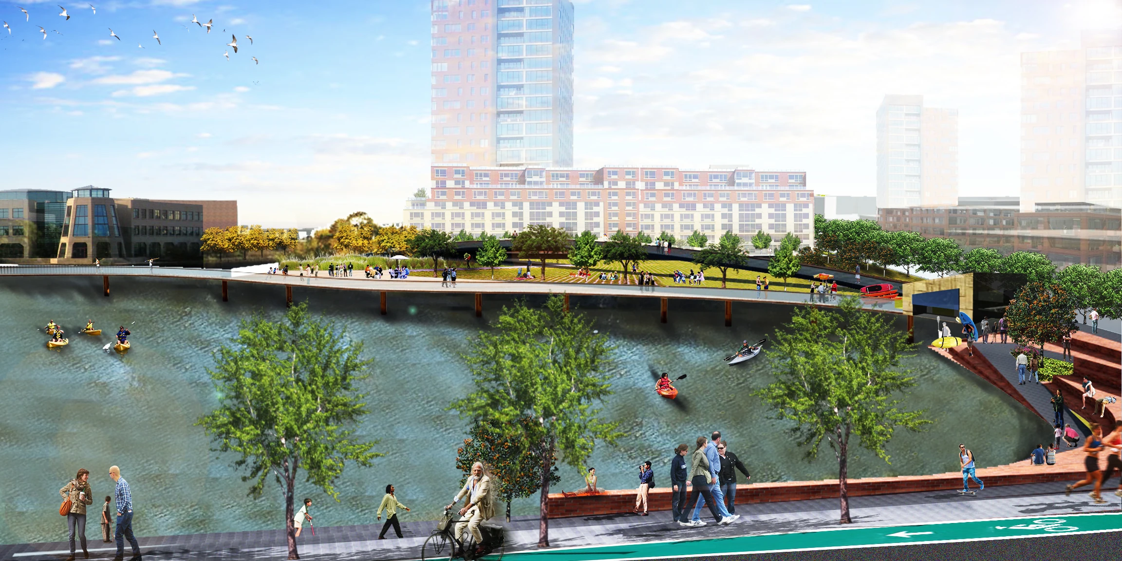
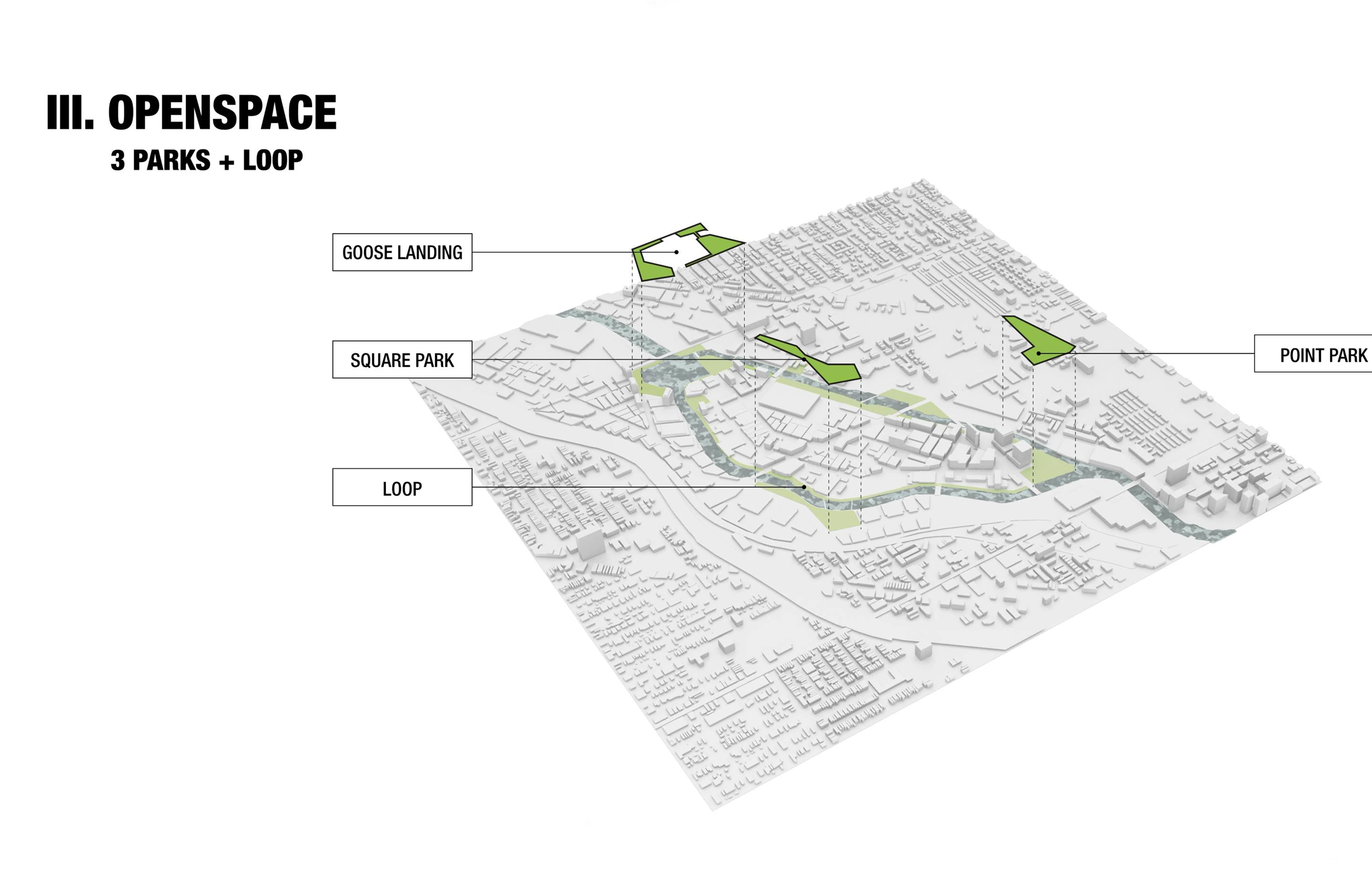
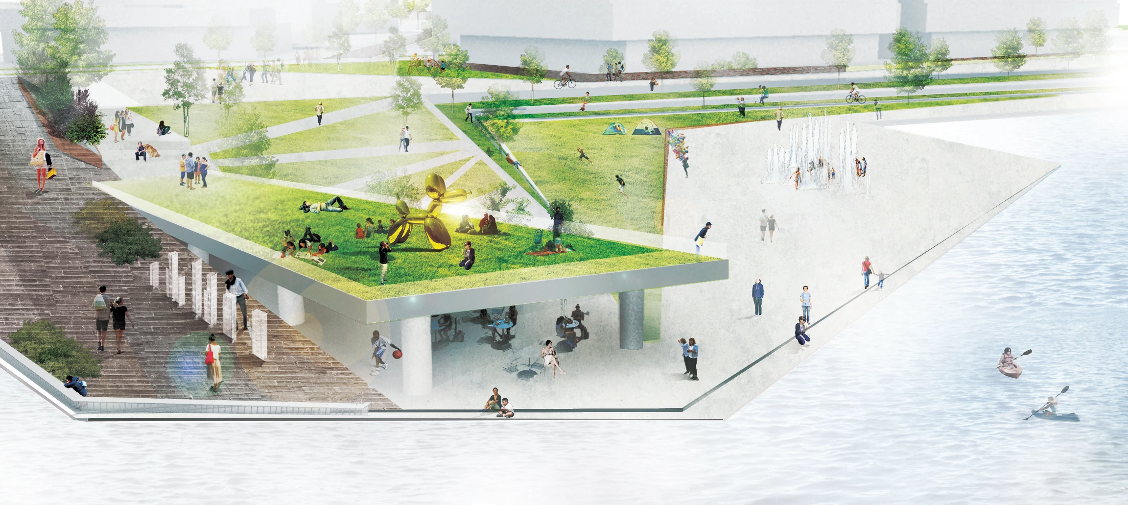
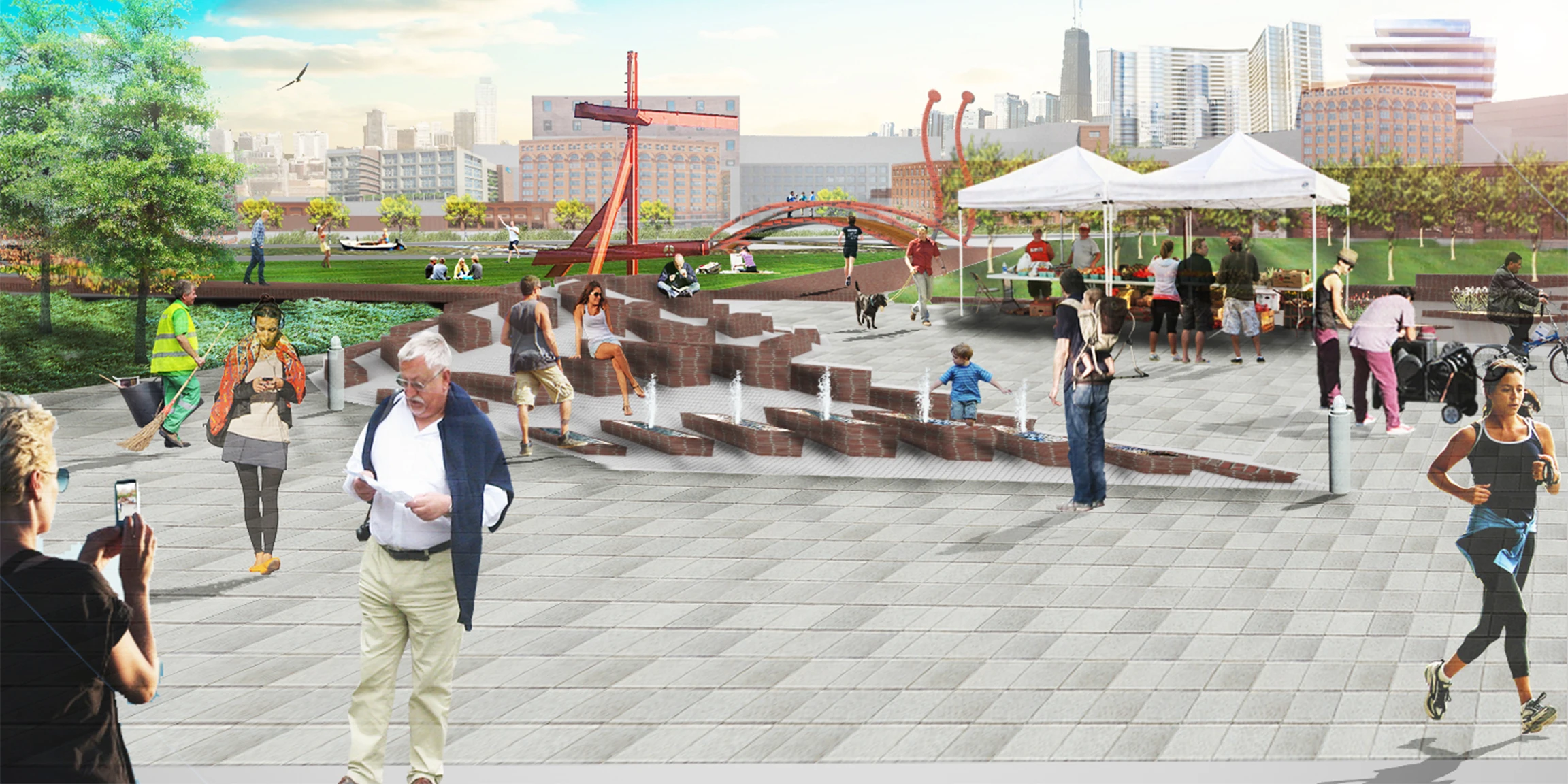
Investment in public open space follows: three parks, Goose Landing, Gateway Square and Goose Point, joined by a Green Loop into a larger network that connects to the Chicago River and the Loop. The parks are meant to raise property values and draw further residential and commercial development.
Connectivity
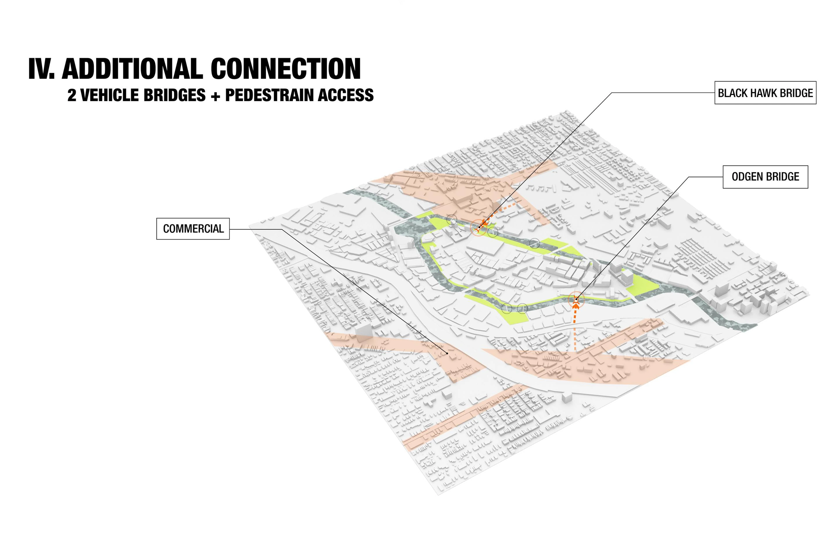
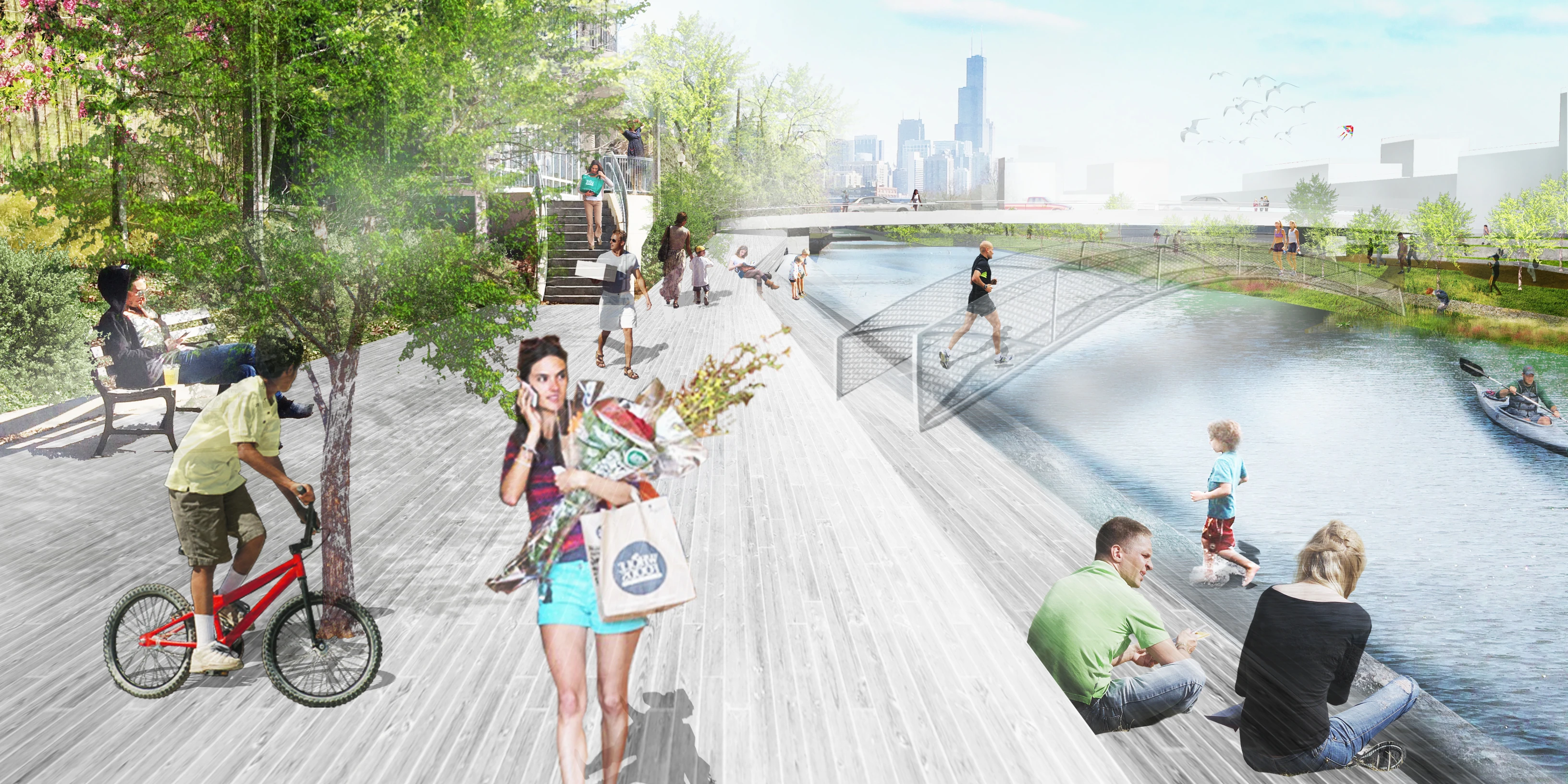
New vehicle bridges at Blackhawk and Ogden, new pedestrian bridges and improved access points let the neighborhoods around the island reach its parks and amenities.
Further development
Last, flexible office space and housing fill key sites near the parks and the commercial cores: clusters of shops, homes and parks, alongside hubs of high-tech office space.
02 Investment phases
Three phases, fifteen years
Investment comes in three phases over 15 years: first the land and the streets, then production space and the first homes, and finally offices, more housing and the open space that ties it together.
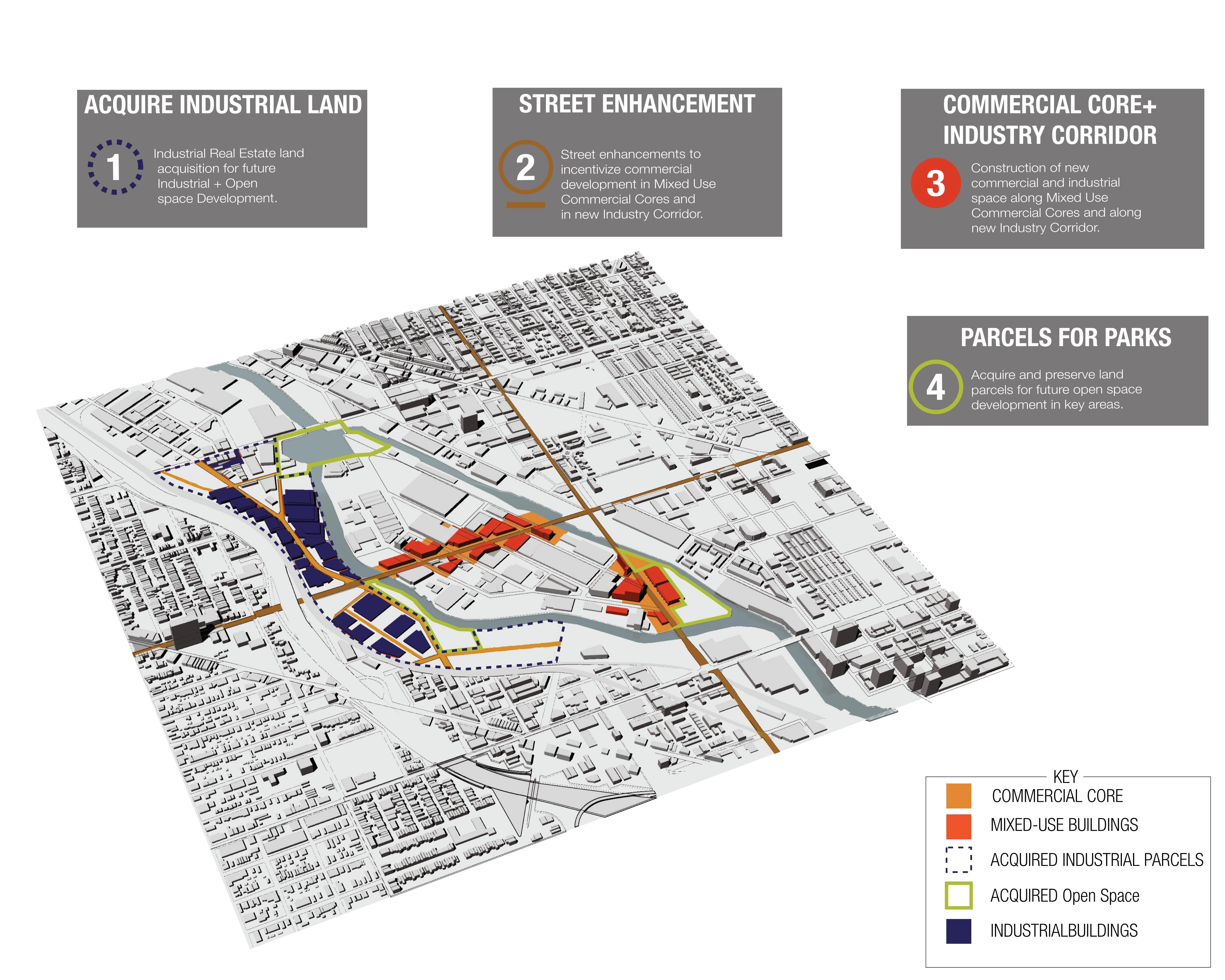
Phase 1: land acquisition, street enhancements and the mixed-use commercial cores
Showing image 01 / 03
03 Masterplan
Tied back into the city
The masterplan brings it together: a district connected to the wider fabric of Chicago through its public open spaces and new connections.