Lewisville Park & Streetscape
WorkTalley Associates · Lewisville, Texas
Lewisville Park & Streetscape
A streetscape, a trail and a pond boardwalk on Summit Avenue in Lewisville, Texas
Project snapshot
My contribution
Role
Urban designer at Talley Associates: sketched layout iterations by hand, and modeled and rendered the site
With
Talley Associates’ design team, which presented the masterplan
Tools
Hand sketching • Rhino 3D • Lumion • Photoshop
Project details
- Location
- Lewisville, Texas
- Firm
- Talley Associates, Dallas
- Clients
- City of Lewisville and the developer
- Project type
- Streetscape, trail and park
- Phase
- Concept design
- Year
- 2019
00 Overview
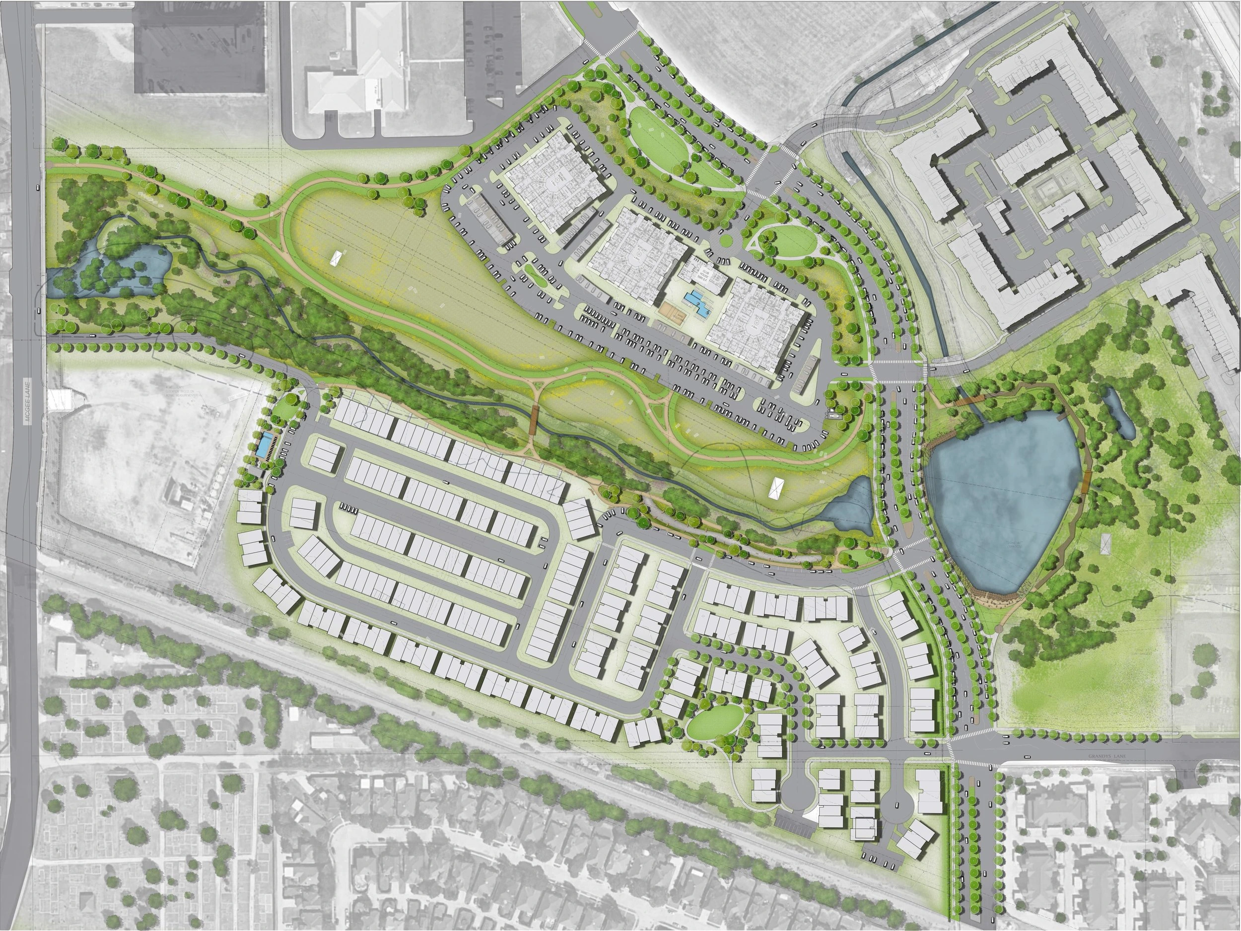
In 2019, as an urban designer at Talley Associates, I worked on the concept design of a streetscape, a trail and a park on Summit Avenue in Lewisville, Texas.
I sketched a range of layouts to meet the vision and requirements of the city and the developer, and our team presented a masterplan. I also modeled the site and rendered it for stakeholders.
01 Design iterations
Layouts by hand
My sketch iterations worked out the layout of the project’s three parts: a streetscape spine along Summit Avenue, a trail along a power-line easement and a boardwalk at a pond, each with a character of its own.
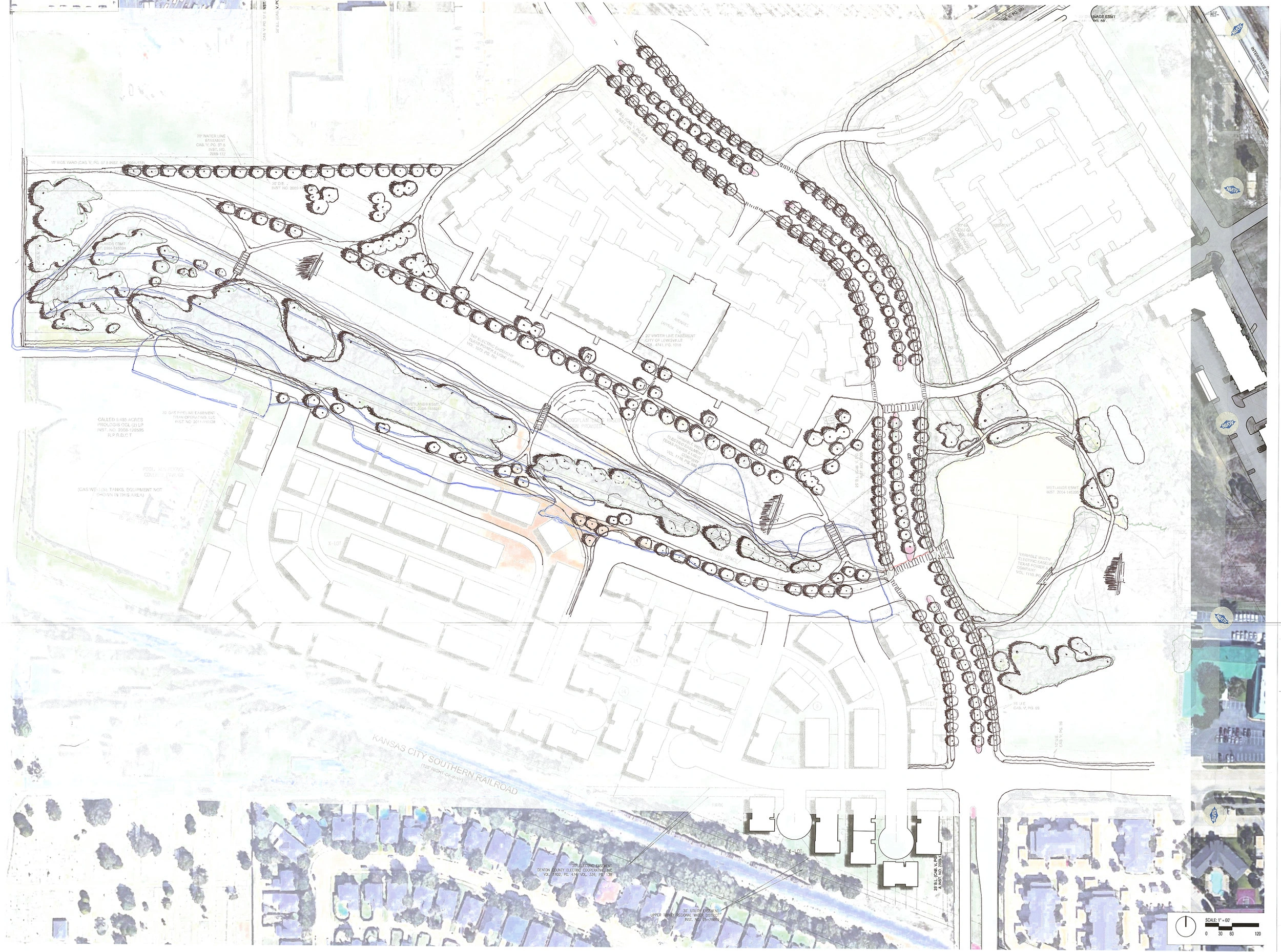
Sketch iteration in ink over a faded print of the site plan and aerial: rows of trees along Summit Avenue, a path looping the pond, and the trail and its bridges along the wooded channel
Showing image 01 / 04
02 Concept presentation
The site, its systems and the street
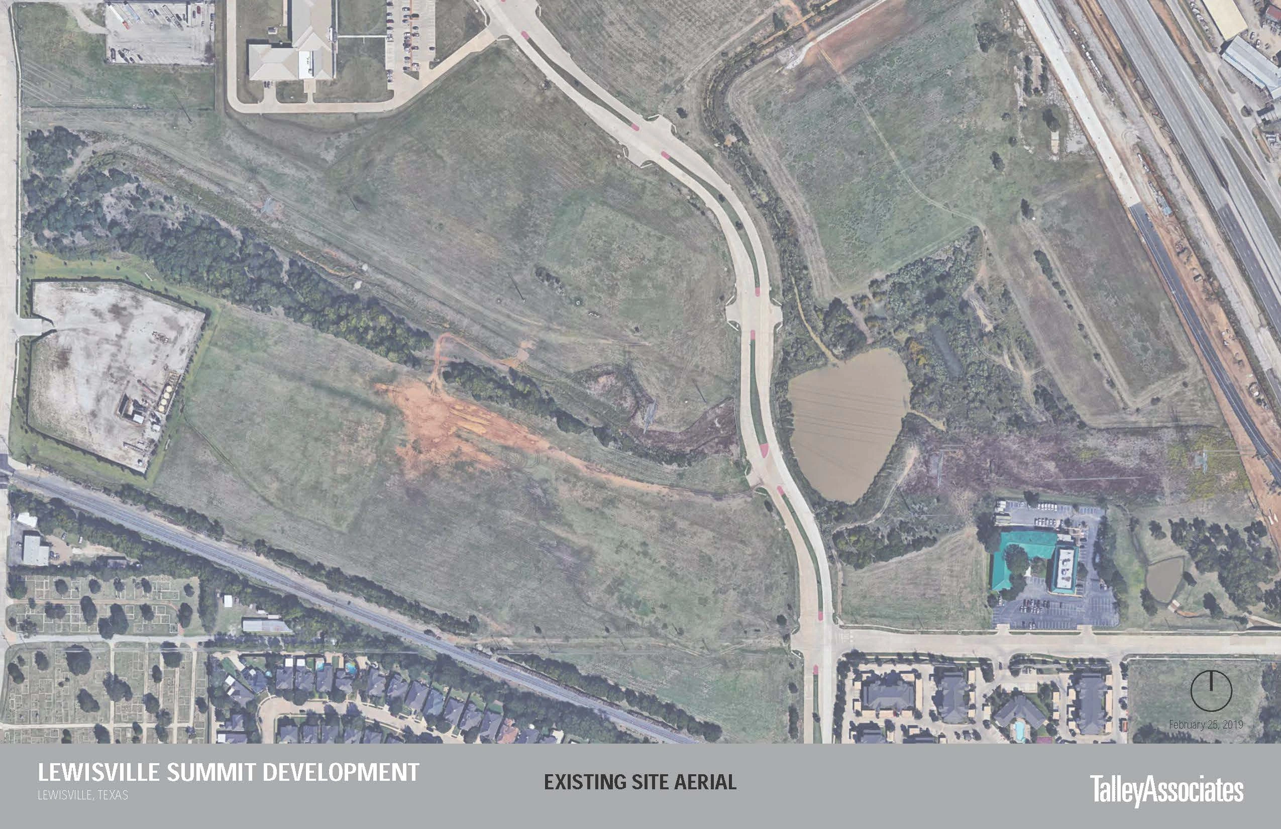
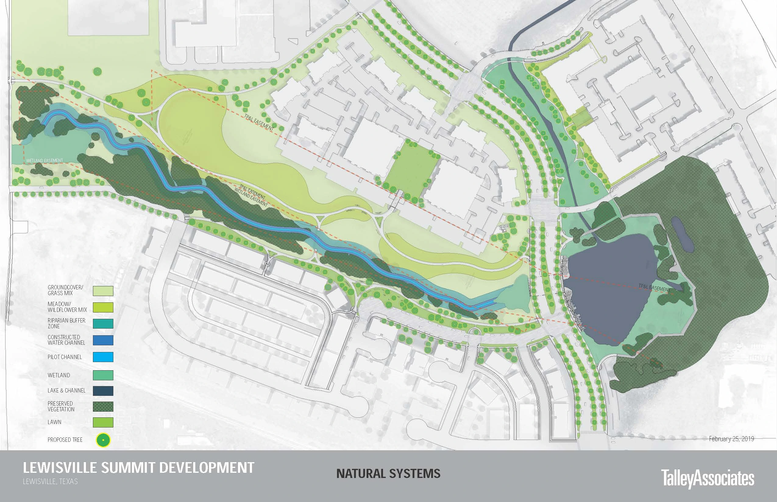
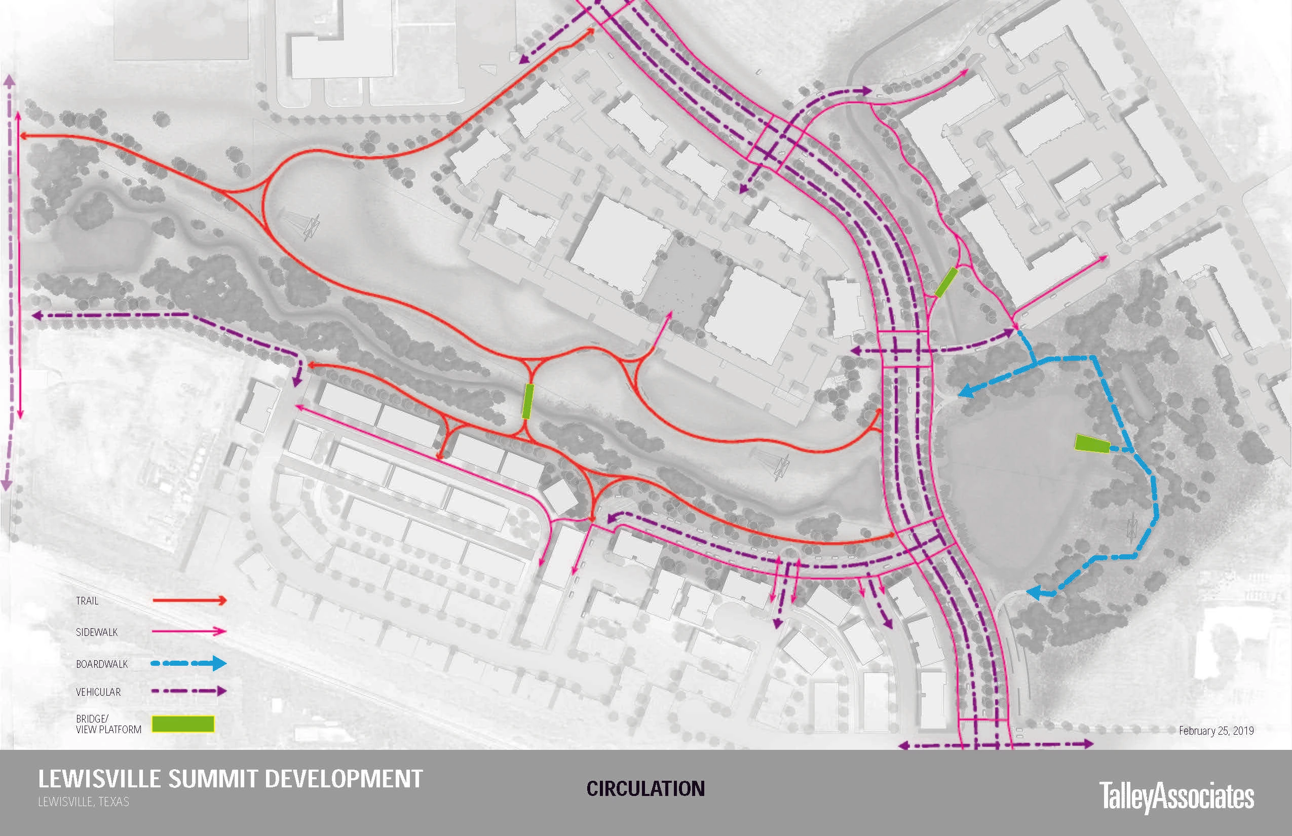
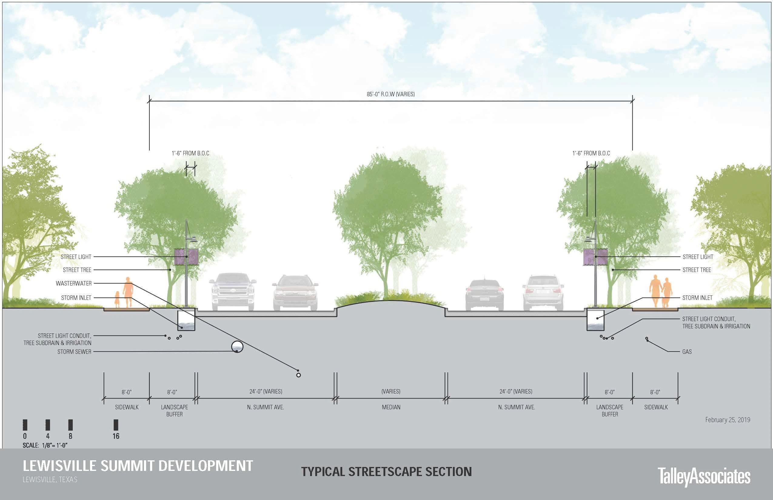
Our team presented the concept on February 25, 2019, with sheets on the site as it was, its natural systems and circulation, and a typical section of Summit Avenue.
03 3D modeling & rendering
The park at eye level
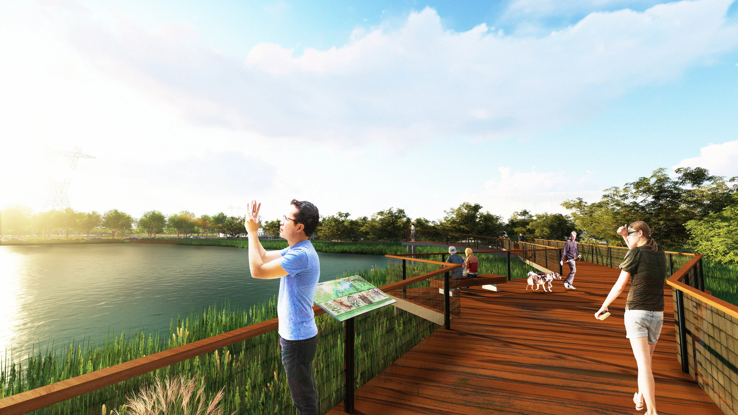
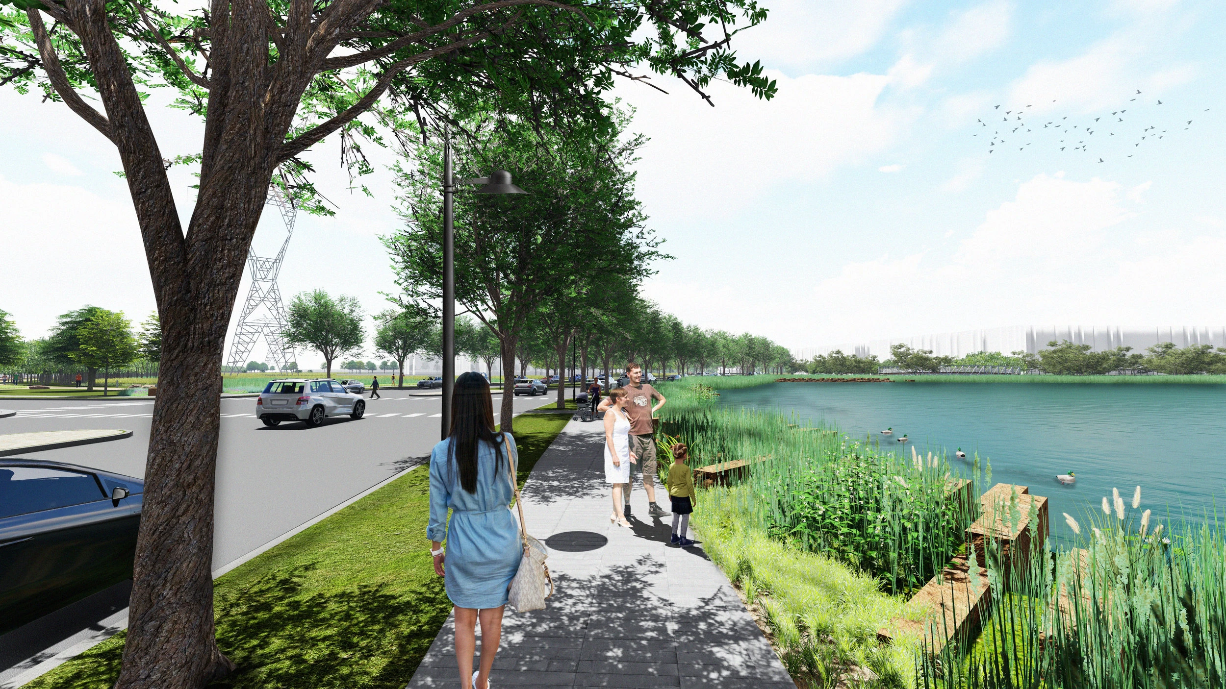
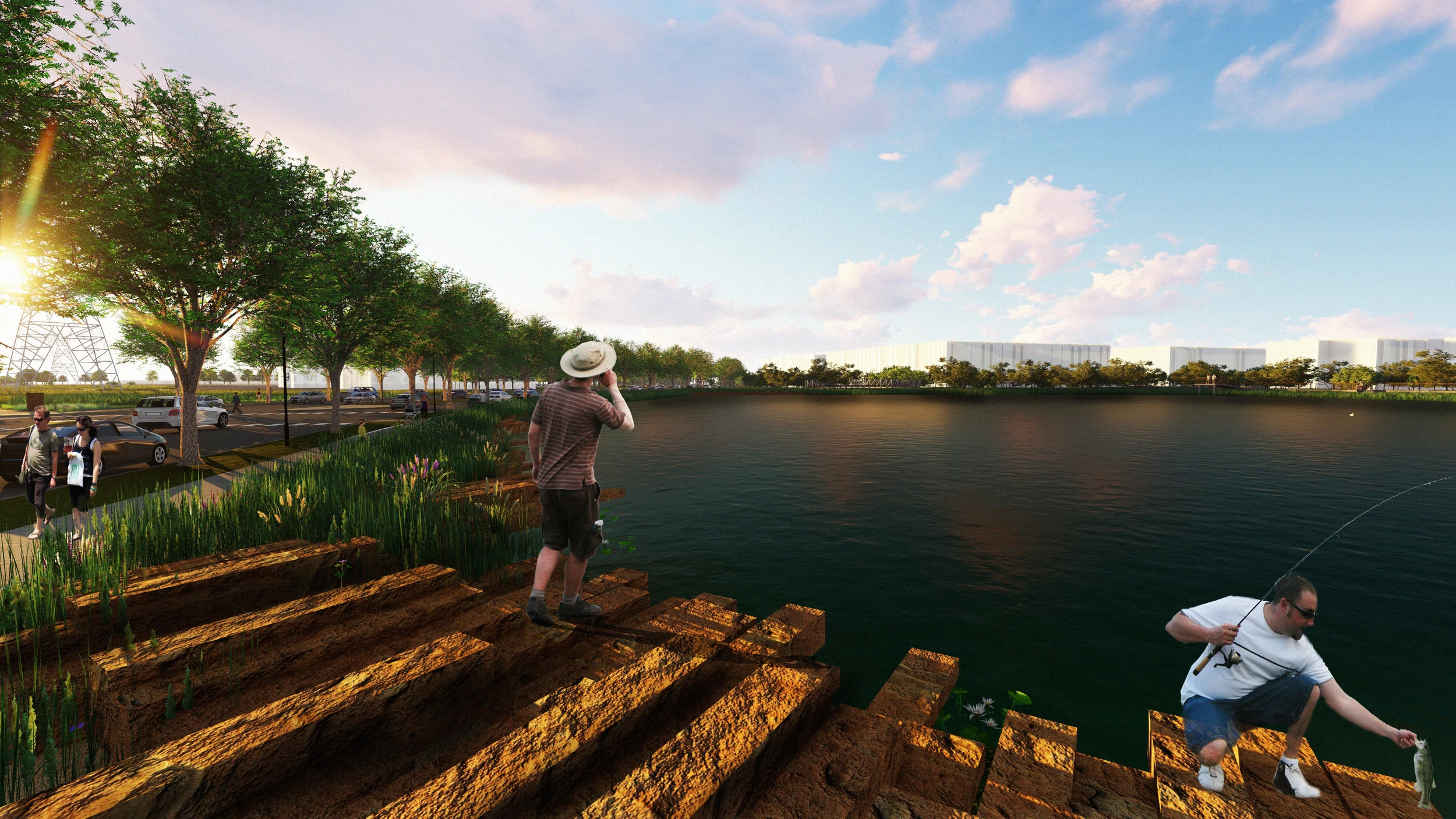
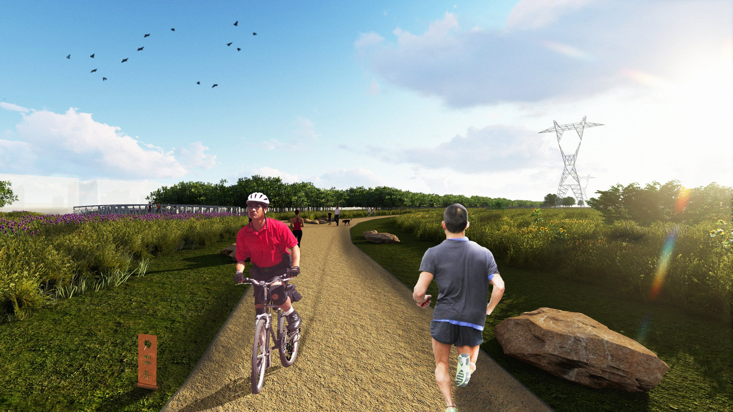
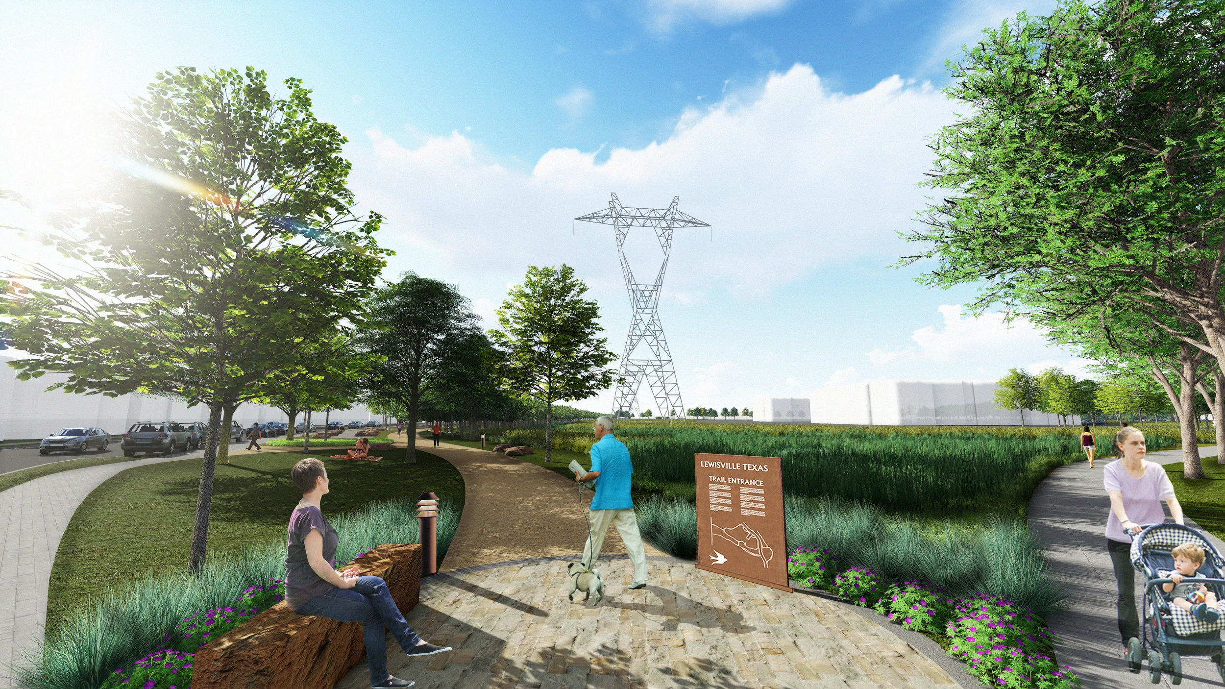
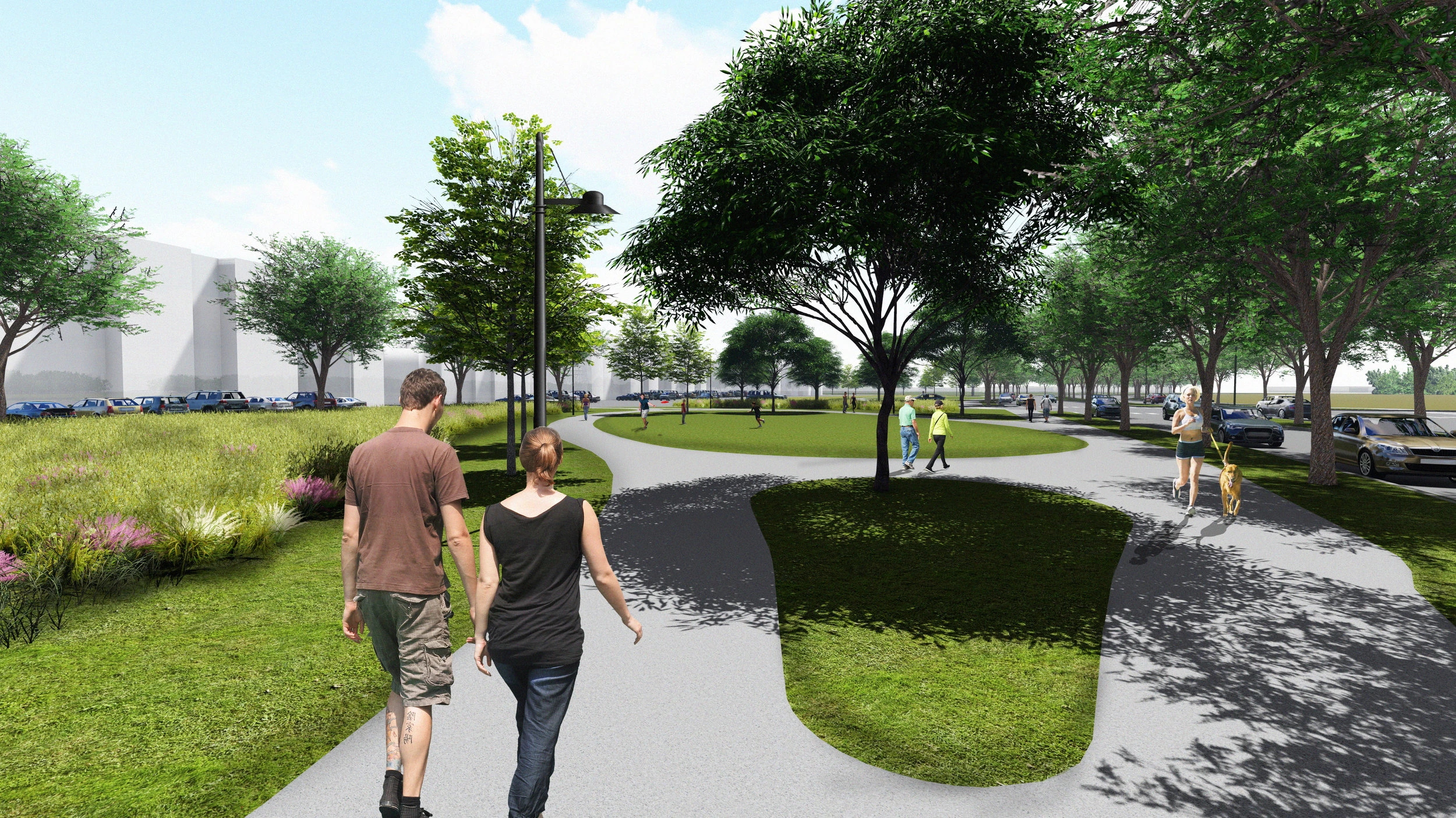
To show stakeholders the park’s character, I modeled the site in Rhino 3D and rendered views of it in Lumion and Photoshop.