UX of a Restored Landscape
WorkUniversity of Pennsylvania · San Antonio, Texas
UX of a Restored Landscape: a San Antonio Park
A channelized creek on San Antonio’s west side, restored as a park for people, habitat and floodwater
Project snapshot
My contribution
Role
Chose the site and developed the proposal, from the city-scale analysis and strategy to the site design and its illustrations
Studio
MLA 702, a Master of Landscape Architecture studio at PennDesign, University of Pennsylvania, Spring 2016 • critics Lucinda Sanders, Trevor Lee and Michael Miller
Scope
Analysis of the West Side Creeks • a deployable strategy for them • the design of 1.3 miles of Zarzamora Creek
Tools
AutoCAD, Rhino 3D, 3ds Max, Photoshop, Illustrator, After Effects, Google Earth
Project details
- Location
- West Side, San Antonio, Texas
- Site
- 1.3 miles of Zarzamora Creek
- Institution
- University of Pennsylvania (PennDesign)
- Studio
- MLA 702, Spring 2016
- Project type
- Park · ecological and flood infrastructure
- Status
- Studio proposal
00 Overview
Between 1957 and 1998, San Antonio straightened and channelized its west side creeks to prevent flooding. The channels no longer do that job, and they wiped out the ecology around them. The neighborhoods along them, predominantly Hispanic and Latino, still flood in heavy rain and are underserved by basic social and ecological amenities.
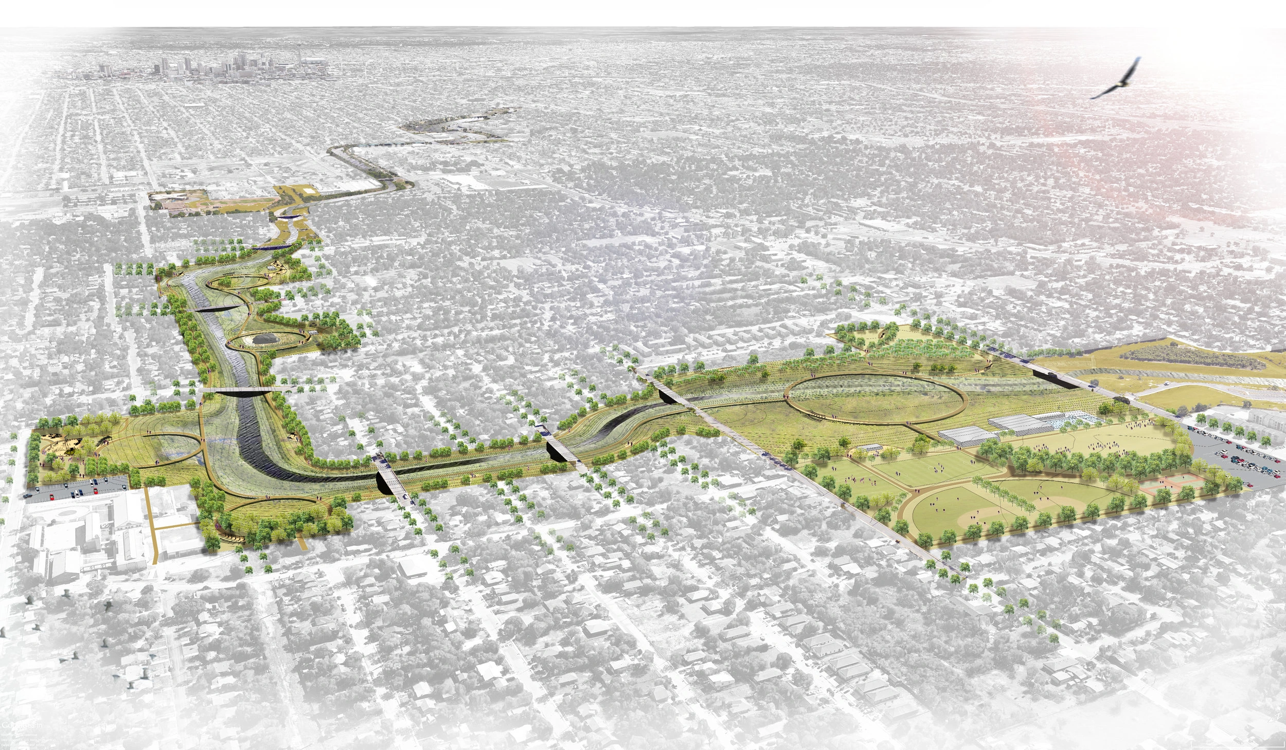
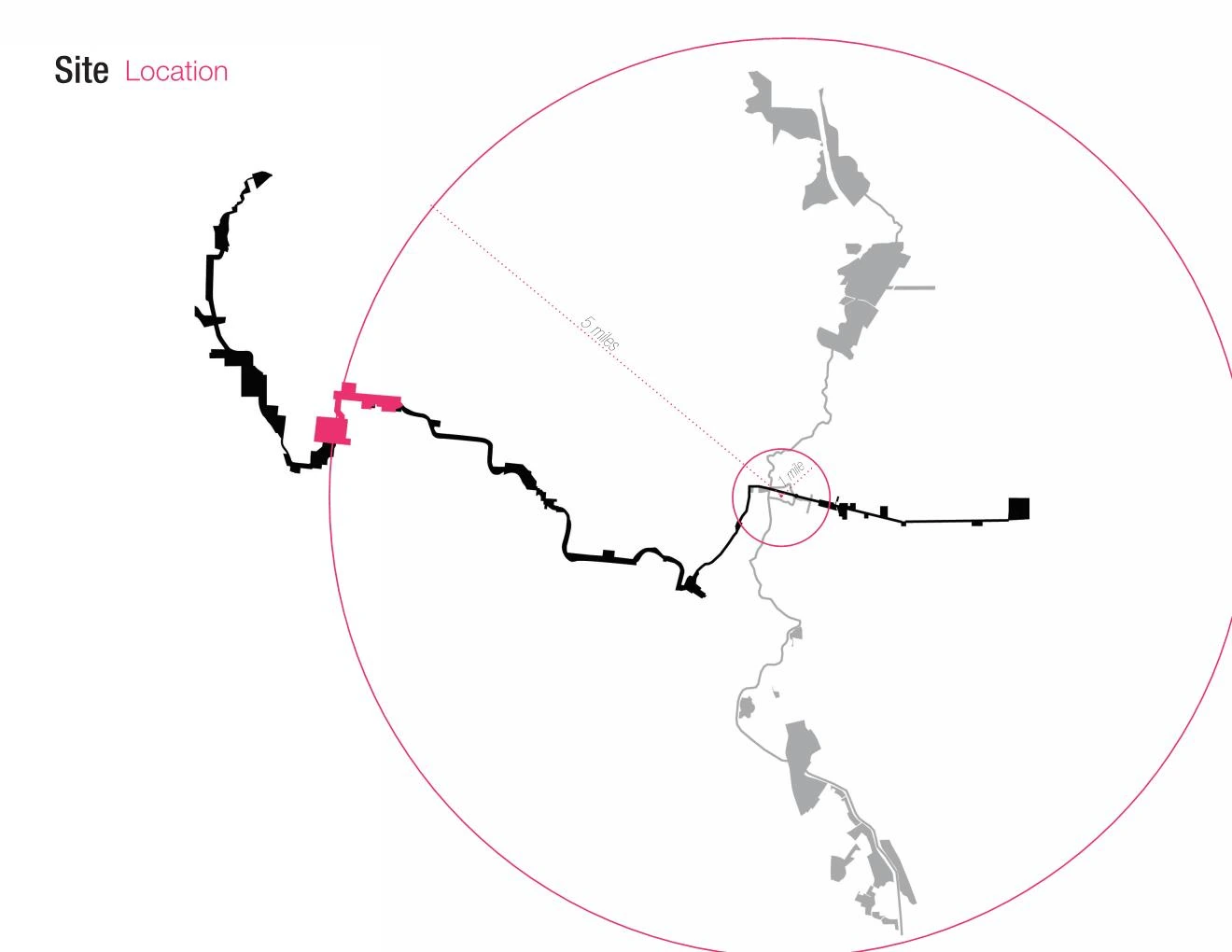
In a spring 2016 studio at the University of Pennsylvania, I proposed San Antoni[ooz]: 1.3 miles of Zarzamora Creek, about five miles west of downtown, restored as a park that interweaves habitat and community and gives floodwater room. The approach is a deployable strategy, designed as a prototype for the rest of the West Side Creeks.
01 The idea
A mythical place that represents danger
San Antonio’s communities seldom think about their creeks or use them. San Antoni[ooz] sets out to challenge the notion that the creeks are inaccessible and dangerous, in a city with a long history of living with its water.
The proposal opens new ways for the community to meet the creeks: their ecology, their recreation, and the water that is the essence of the city. In a storm, the same park holds the flood.
The name reads zoo backward. In the [ooz], the community meets wildlife in the creeks and learns from it.
02 Site
From west to east
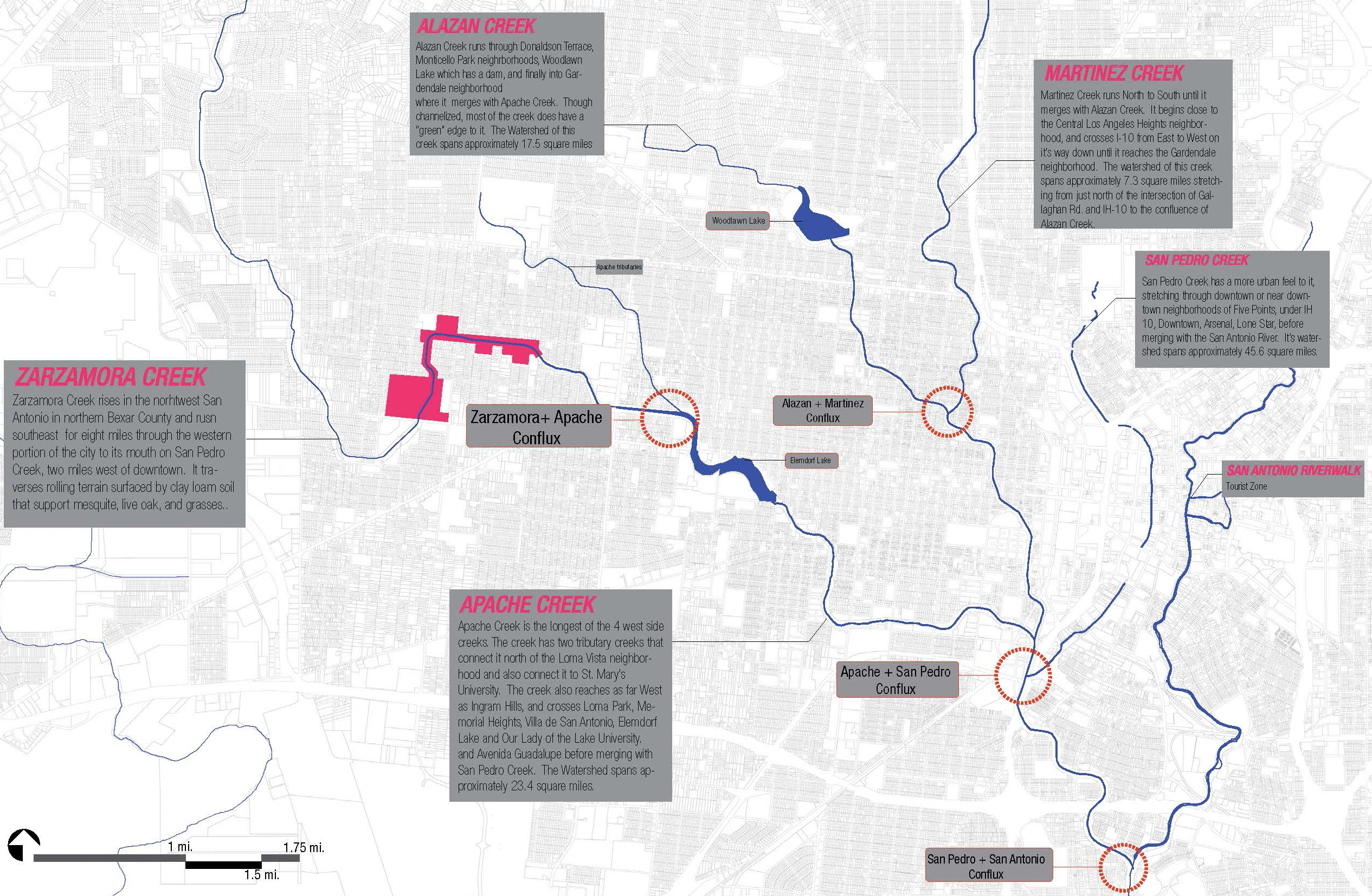
San Antonio’s north–south corridor along the San Antonio River, built around tourism and downtown redevelopment, is established. This project makes the case for a west–east one, along the city’s West Side Creeks.
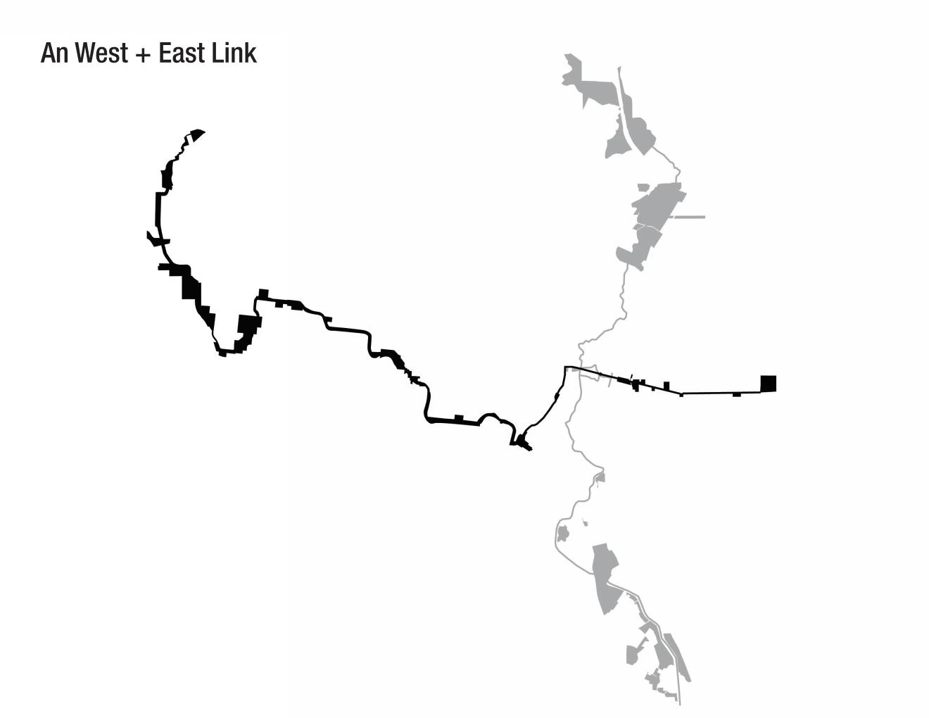
West Side Creeks
San Antonio is committed to water conservation and flood prevention, but that effort has focused on downtown, leaving the communities to the west underserved.
03 Water
Channelized, and still flooding
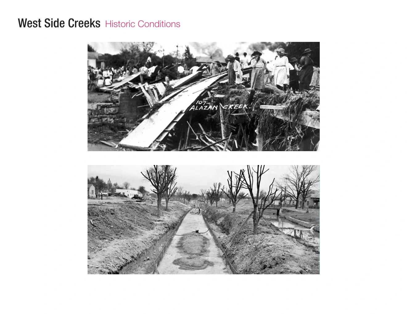
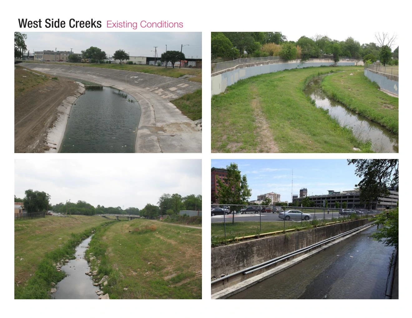
The city straightened the natural creeks and lined them with concrete to prevent flooding from storms. Downtown San Antonio no longer floods. The west side often does.
In their current form the creeks are desolate, a no-man’s land cut off from their communities physically and psychologically.
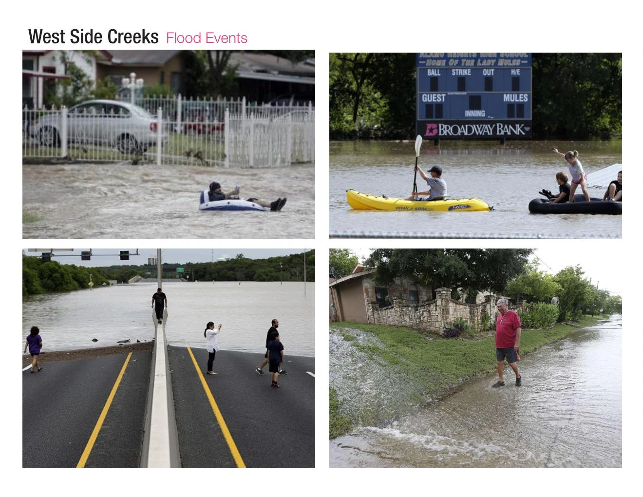
175+flood events recorded in San Antonio from 2000 through 2013, an average of 13 a yearMost of them on the west side
04 People and ecology
Where people live, where the parks are
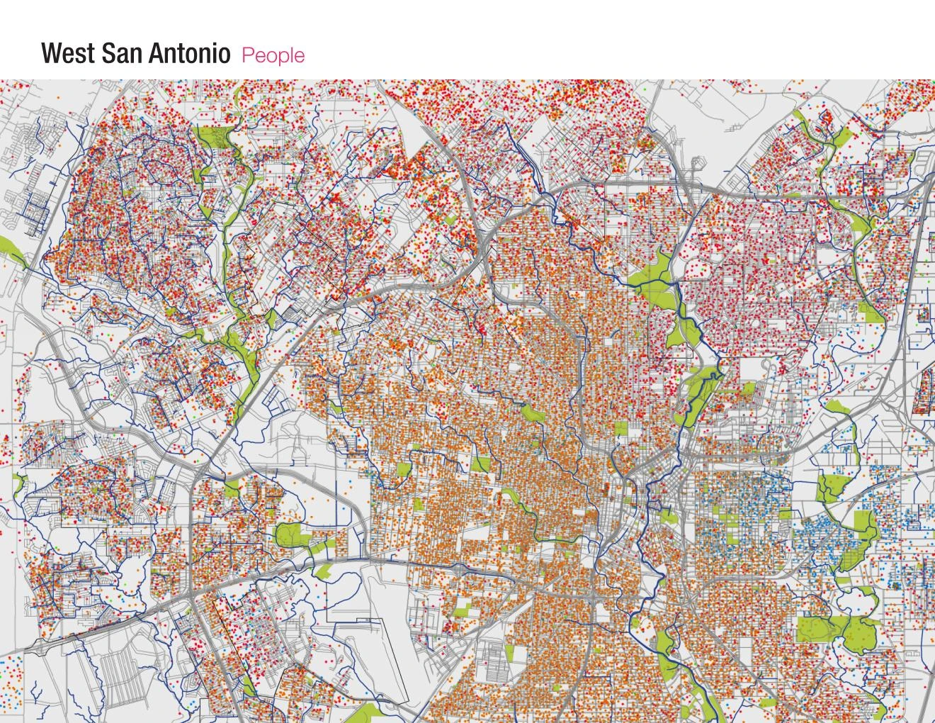
West San Antonio, where most of the floods happen, is predominantly Hispanic and Latino. The map sets where people live against where the public green space is.
Native ecology
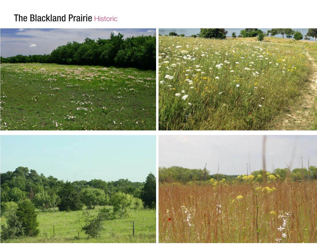
Historically, west San Antonio was Blackland Prairie: clumps of woodland, tall grasslands and meadows, and abundant streams.
Impervious surface and green cover
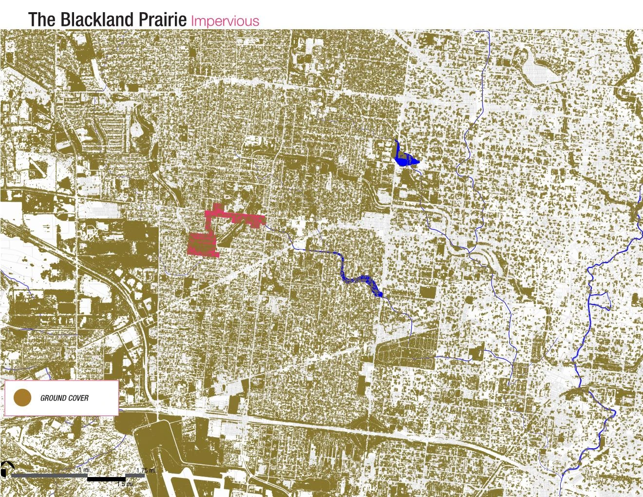
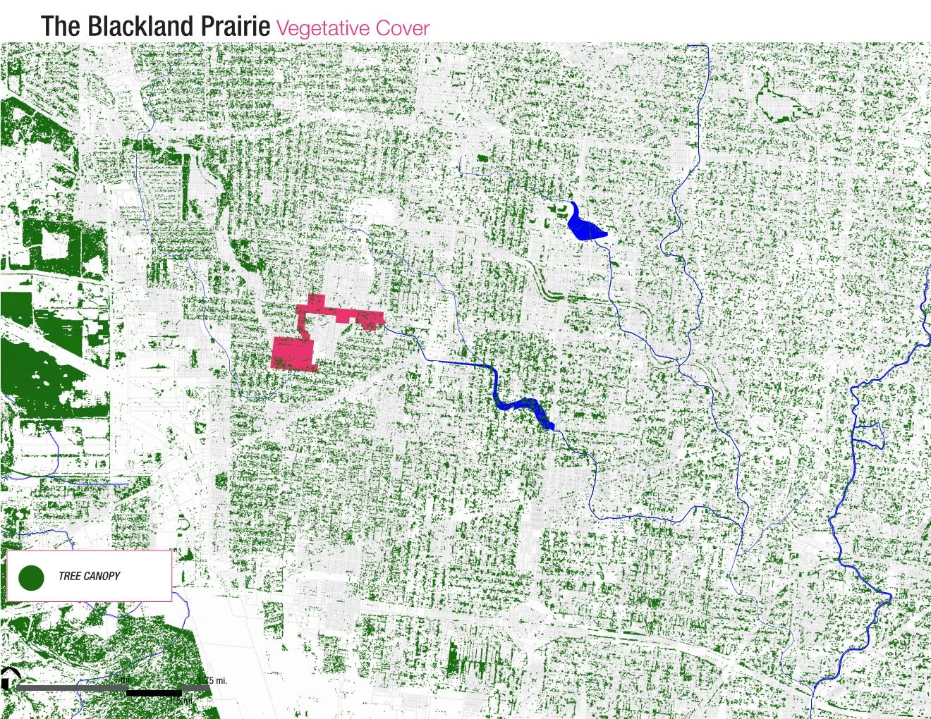
As San Antonio grew, urbanization disturbed those systems, created many of today’s flood hazards and spurred the channelization of the creeks. Impervious development, which keeps rain from recharging the water table, now outweighs vegetative cover, so rain events end in floods.
05 Larger strategy
A natural link through the city
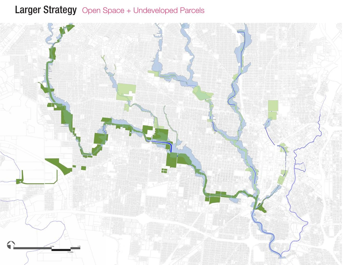
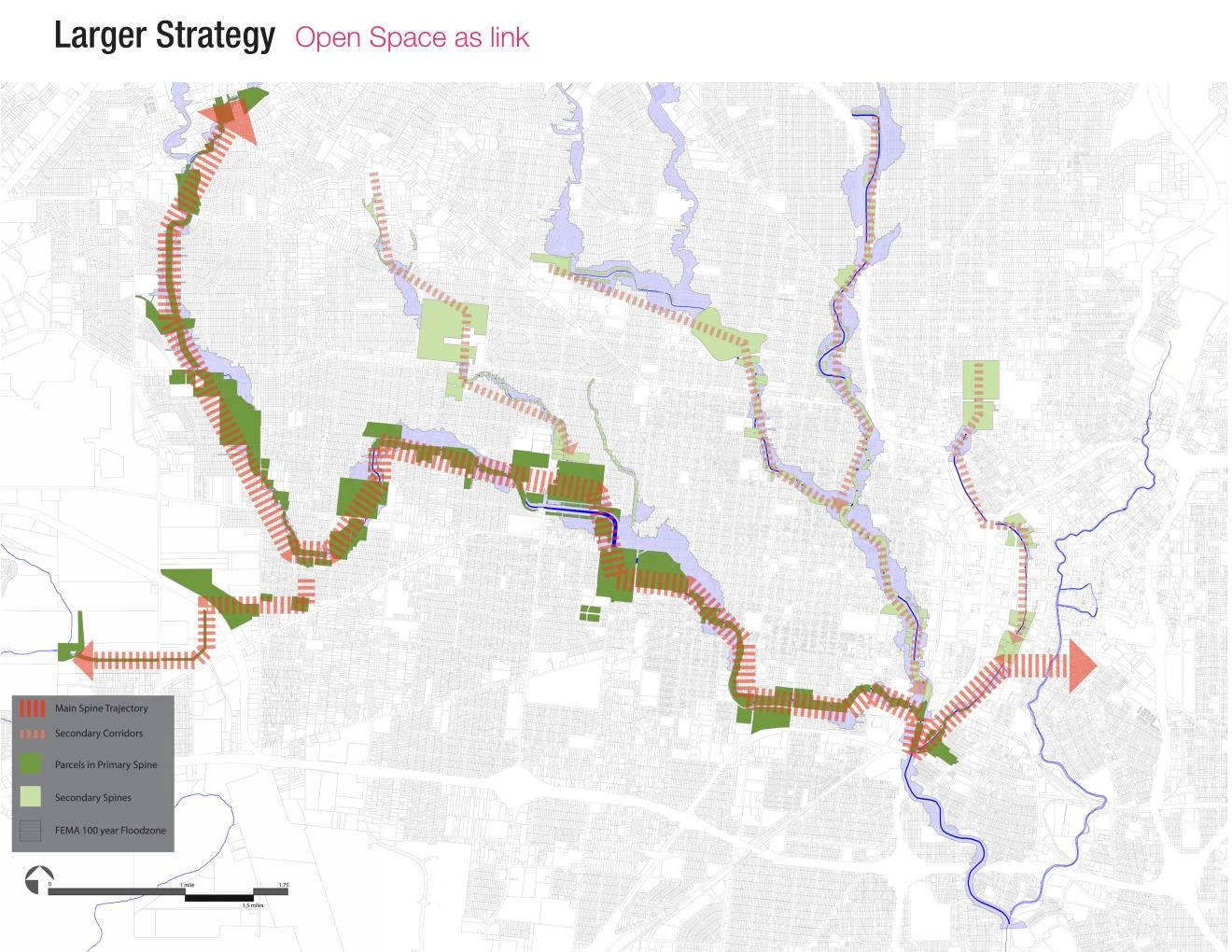
The larger strategy proposes naturalizing the creek channels where they pass undeveloped or underdeveloped parcels, creating a resilient open space that can help reduce flood risk.
With public access and room for program, the naturalized creeks become a link: an element that runs continuously through San Antonio’s urban fabric.
Program needs
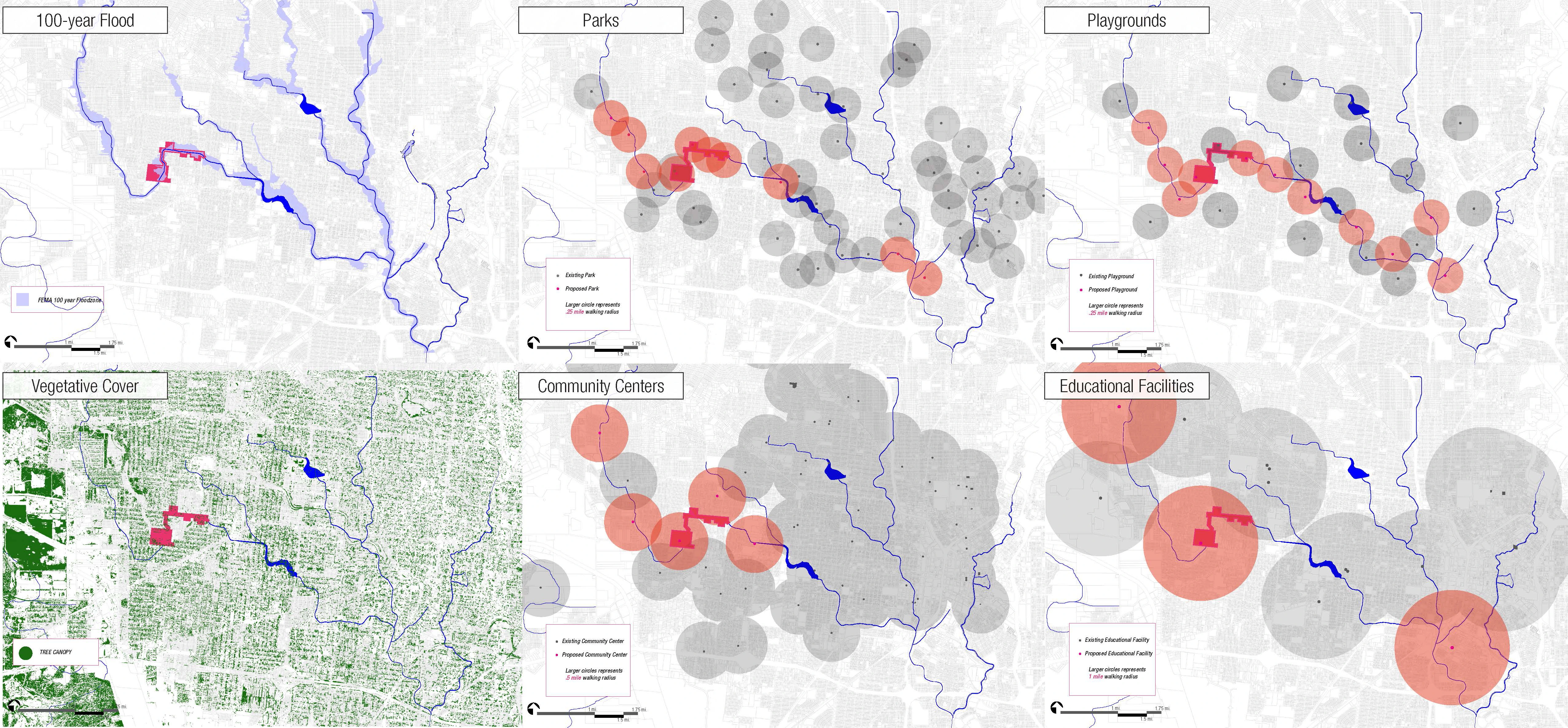
Once the creeks connect, the question is what their communities need. Mapping parks, playgrounds, community centers and educational facilities against the creeks, each with its walking radius, showed where new ones could go along them.
06 Design strategy
Open at the edge, intimate at the creek
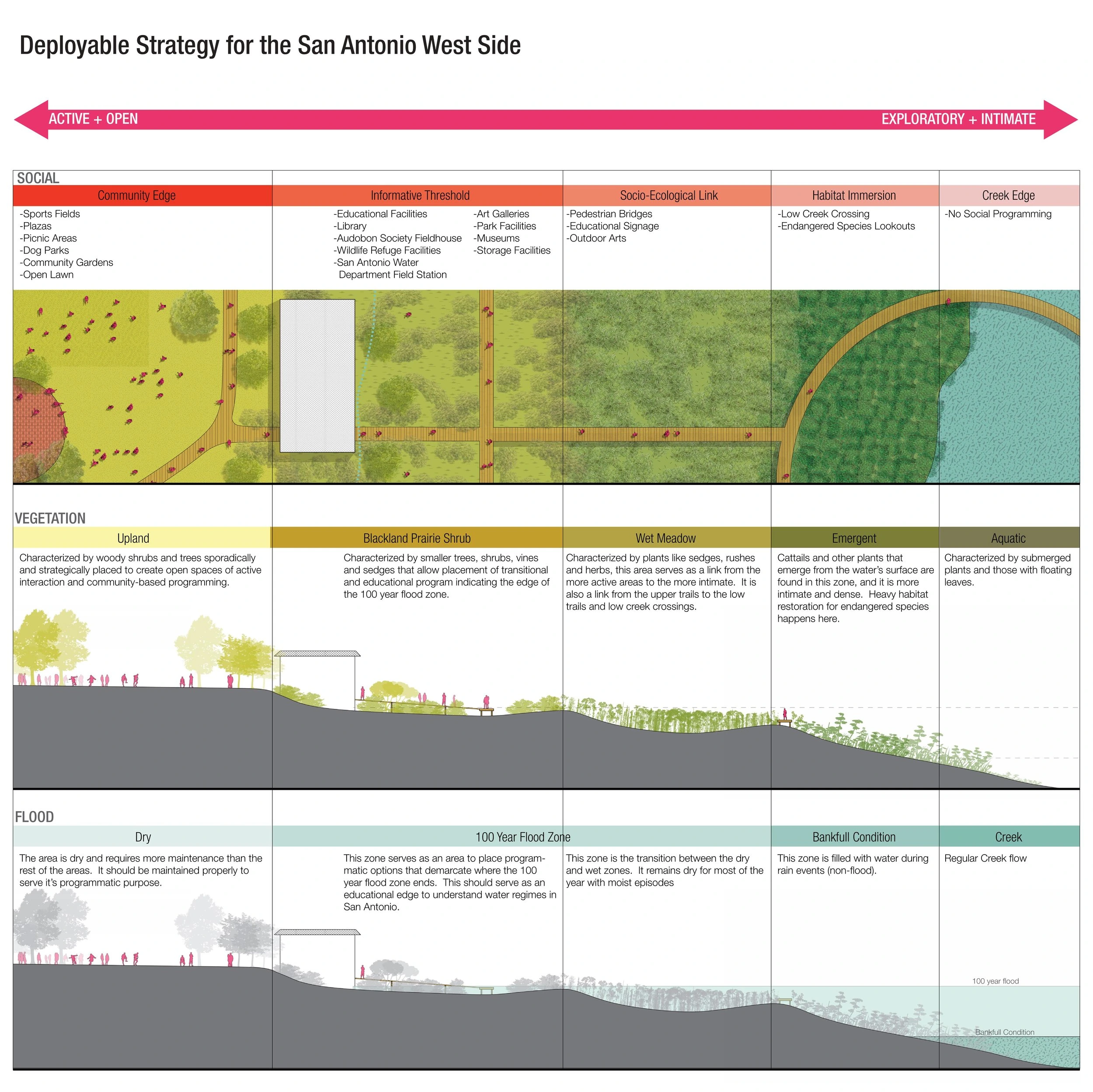
At a smaller scale, the design strategy sets up conditions for program, vegetation and water: a prototype meant to be repeated along the rest of the West Side Creeks.
Closer to the community edge, the space is open, active and safe from floods. Nearer the creek it becomes intimate and exploratory, and water is free to flood naturally during storms. How it plays out depends on the land available beside the creek.
07 Project site
The strategy, on Zarzamora Creek
The strategy was then deployed on the chosen site, where conditions were harsh: damaged sports fields, concrete channels, little vegetation and frequent floods.
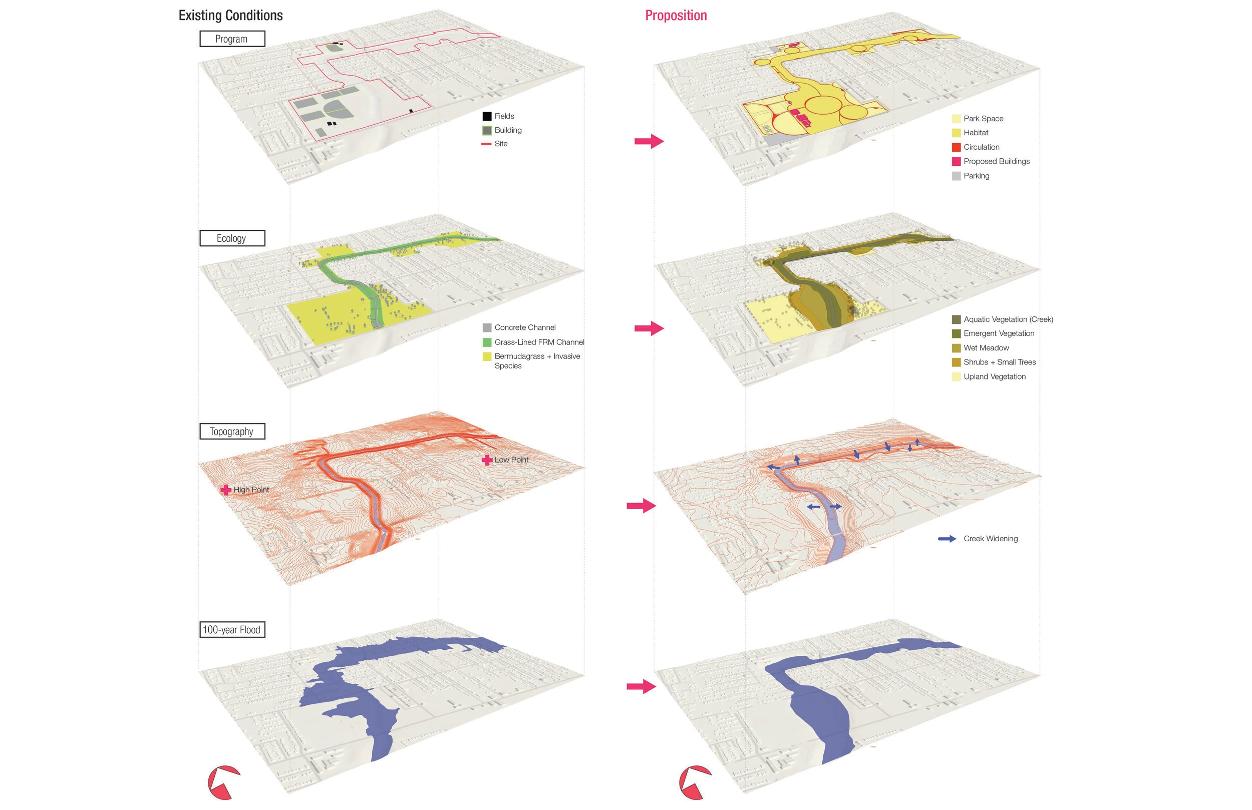
The proposal adds public access through a trail system, community spaces, playgrounds and parks, and richer vegetation, so the community can walk into the creek’s ecology. Widening the creek onto vacant land lets the site hold more water in heavy rain, protecting the neighborhoods beside it and relieving the creek downstream.
![Illustrative plan of the San Antoni[ooz] park on Zarzamora Creek, keyed 1 to 16: a recreational and educational facility, Arroyo Bend park and sports complex, a public pool, Los Jardines, six habitat immersions, neighborhood parks, Loma Vista Nook and parking, with the 100-year flood condition inset](/media/user-experience-in-the-landscape/user-experience-in-the-landscape-archive-22-4800w.webp)
08 Site design
Four places, at bankfull and in a flood
Once the design was refined, I illustrated four portions of the park: each one’s existing condition, and how it works in a normal state and during a storm.
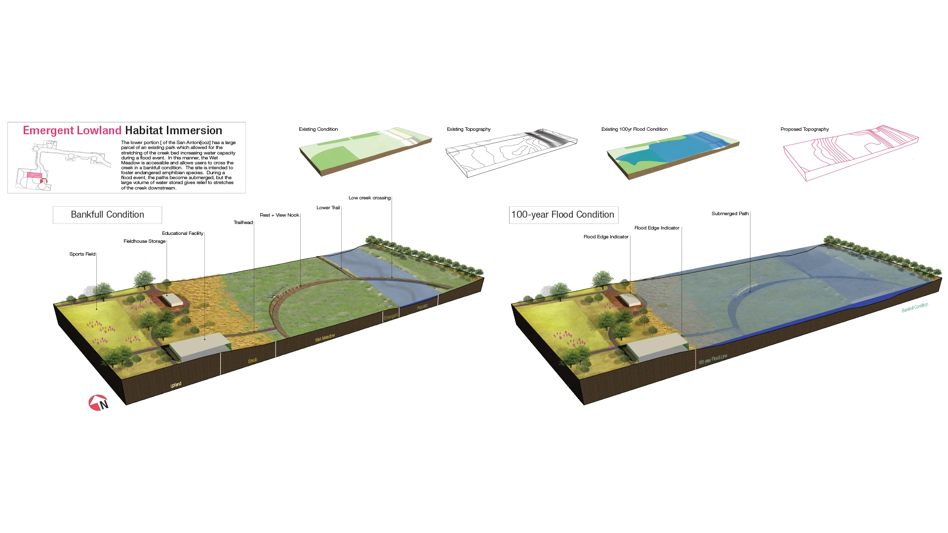
01 · Emergent Lowland: the creek bed stretched across an existing park to hold more water
Showing image 01 / 04